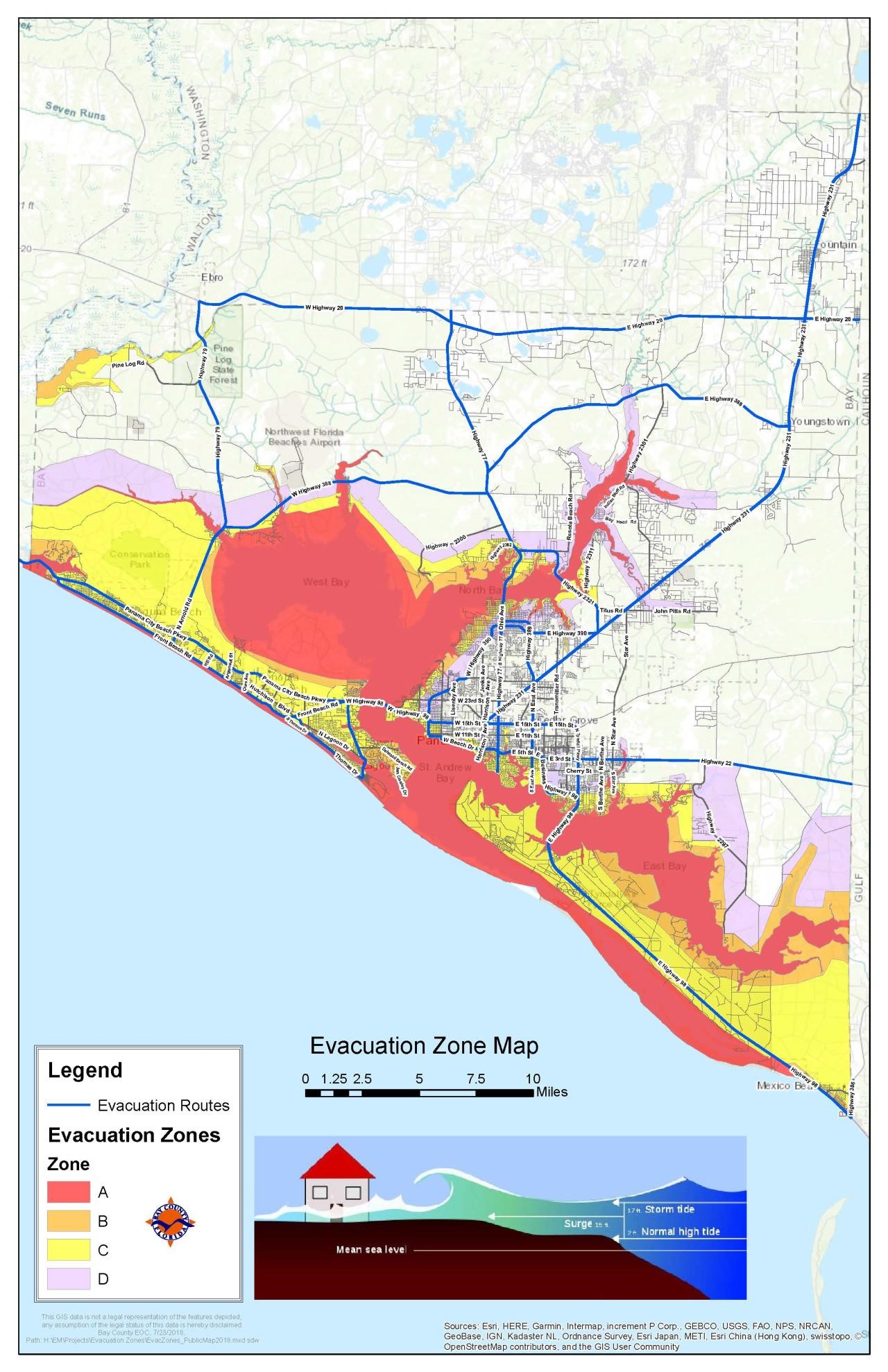


Bay County Evacuation Map
Bay County, Florida – Evacuation Zones
<iframe src="https://gis.baycountyfl.gov/evac.html" style="width:100%;height:1000px;"></iframe><!-- [et_pb_line_break_holder] --><!-- [et_pb_line_break_holder] --><!-- [et_pb_line_break_holder] -->
Download a PDF of the Bay County Evacuation Map