A Tropical Storm is Likely to Develop Near Florida, but Uncertainty is High on Where it Goes
FPREN HQ – A strong tropical wave over the southeast Bahamas is on track to become a tropical depression by Friday, and potentially Tropical Storm Humberto over the weekend.
The National Hurricane Center has increased the chances of tropical cyclone development to 70% over the next two days and 80% over the next five days. The tropical wave could develop anywhere from the eastern Gulf of Mexico to the western Atlantic based on its 2 pm tropical outlook.
NHC continues to monitor a disturbance in the Bahamas that is likely to become a tropical depression or storm in the next day or two as it moves northwestward. Interests in the central and NW Bahamas and Florida should monitor its progress https://t.co/tW4KeFW0gB #95L pic.twitter.com/dxGaWhbDDt
— National Hurricane Center (@NHC_Atlantic) September 12, 2019
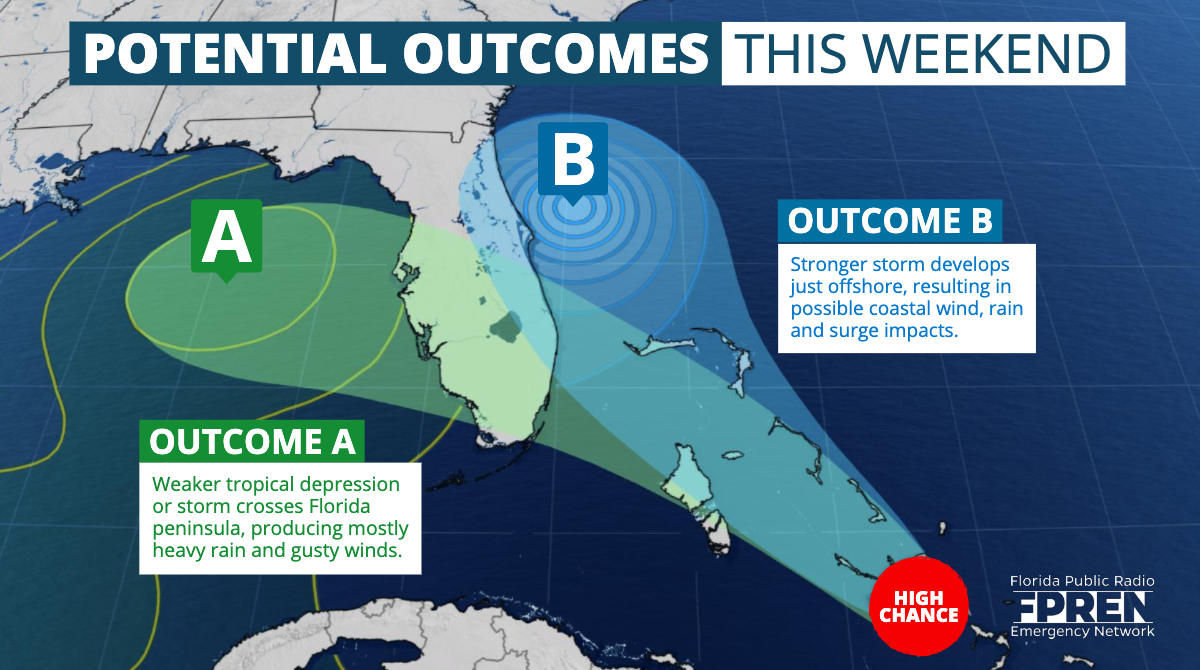
There are considerable differences between the most reliable models where the tropical wave will go and how strong it may get. The U.S. global model is forecasting a weaker system moving across Florida late Friday into Saturday before heading toward the central Gulf Coast Sunday evening. If this occurs, an increase in showers are expected over central and south Florida on Saturday, spreading to the Big Bend and Panhandle Saturday night into Sunday. The rain would be welcome in the Big Bend and Panhandle where some areas are experiencing moderate drought according to the NOAA Drought Monitor.
Two models run in Europe — the UKMET and ECMWF models — have made a significant change since yesterday and show a stronger tropical storm forming near the Atlantic coast of Florida this weekend. If this happens, rain and gusty winds would be confined primarily to the Atlantic coast in Florida. The rain bands could reach parts of southeast Florida late Saturday and spread up east coast of the state on Sunday and Monday. In this scenario, the exact track would determine how significant the rain and wind will be. A more offshore track would result in fringe effects, while a track hugging the coast may result in heavy rain, strong winds, and beach erosion. The Florida Panhandle would receive little or no rain.
Another tropical wave near the Cape Verde Islands has a chance to develop next week as it heads toward the Caribbean. The National Hurricane Center says there is a 40 percent chance a depression could form. It is far too soon to know if there will be any effects over the U.S. mainland from this tropical system. If there are any, those effects would be more than a week away.


