Another Tropical Wave is Likely to Skirt by South Florida
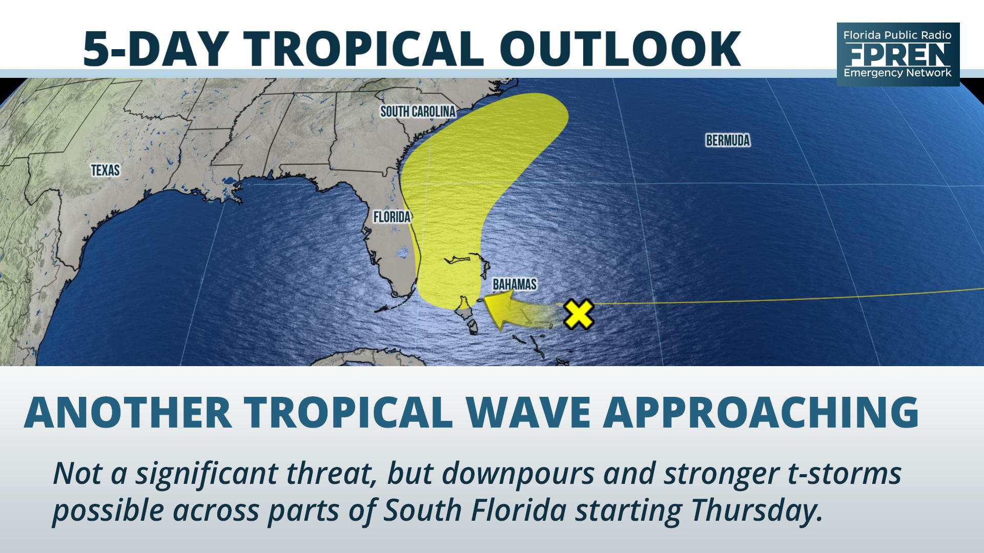
Gainesville, Florida – Showers and thunderstorms will become more numerous at times across the Florida peninsula by the end of the week thanks to an approaching tropical wave.
The wave is not expected to become a significant tropical event, but it is being monitored by the National Hurricane Center for potential development into a depression or a tropical storm over the next five days.
Nothing much Wednesday
The subtle uptick in rain chances will begin Wednesday in portions of Southwest Florida, thanks to an Atlantic sea breeze that will move east-to-west across the peninsula by late afternoon. Residents near cities such as Tampa, Sarasota, Fort Myers or Naples might have to navigate through a few stronger cells during their afternoon commute, but rain chances will be near normal for the rest of the peninsula through early evening, with only spotty activity expected.
Higher chances Thursday
Deeper moisture from the tropical wave will approach South Florida Thursday. This is when showers will become more prevalent near Miami, Fort Lauderdale and West Palm Beach, possibly arriving as early as daybreak. Although the rain is not expected to be long-lasting, areas that have experienced localized flooding recently may see that reoccur where some of the heavier downpours are concentrated.
Thunderstorms will once again be possible Thursday afternoon in west-central and southwest Florida from the same setup that triggers Wednesday’s activity. Added moisture and instability could lead to some stronger cells capable of producing minor wind damage, especially for areas near the Gulf Coast during the late afternoon or early evening hours. Locations further north, near cities such as Orlando, Ocala and Daytona Beach, might also experience an uptick in daily thunderstorm activity by Wednesday afternoon.
System slows down Friday
The tropical wave is expected to slow down some Friday as it moves over the Gulf Stream between Miami and The Bahamas. The deepest moisture from this system will likely be on its eastern side, keeping the heaviest rain offshore. However, numerous showers and thunderstorms are still anticipated across much of the peninsula, especially during the warmest and most unstable part of the day (afternoon and early evening). Locally heavy rain and gusty winds will be possible in the strongest cells.
Pulls away this weekend
Regardless of potential development, all reliable forecast data suggests the tropical wave will generally remain weak and stay offshore. The same model simulations also suggest it will gradually turn to the northeast and move away from Florida this weekend. However, in its wake, a large area of tropical moisture is forecast to remain parked over the state through Sunday. As a result, rain chances will remain elevated in most areas during the afternoon and evening hours, before gradually returning to normal by early next week.
Story by FPREN Meteorologist Jeff Huffman


