


Helene strengthens, extensive catastrophic and deadly impacts
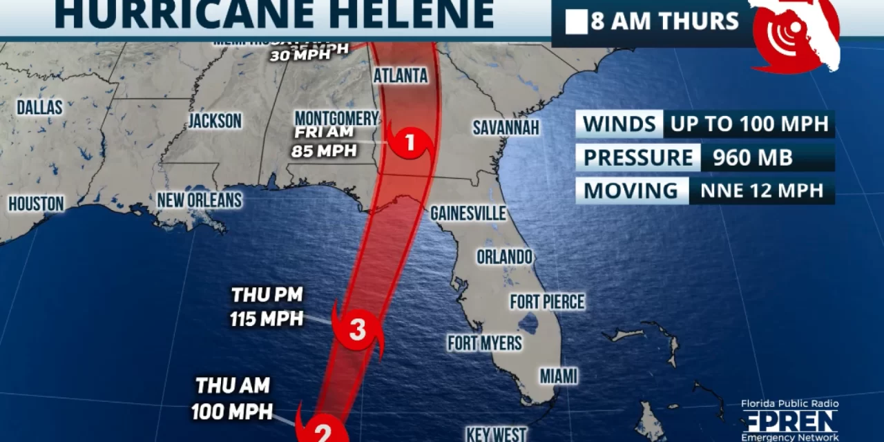
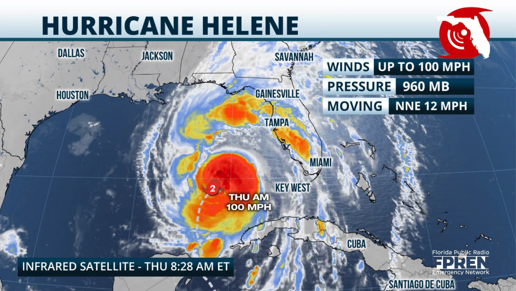
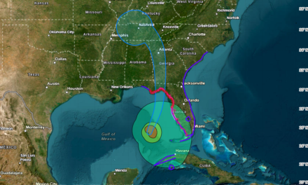
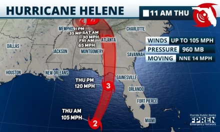
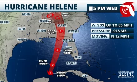
FPREN – Hurricane Helene, with maximum sustained winds of 100 mph, is on the verge of becoming a category 3 hurricane as it races northward over the Gulf of Mexico. It is located 320 miles southwest of Tampa and will be parallel to Tampa, but staying about 150 miles west of Tampa around 3 p.m. on Thursday. The hurricane will continue to strengthen, likely reaching maximum sustained winds of at least 130 mph by the time it lands tonight along the Florida Big Bend, likely between Bald Point State Park and Eastpoint.
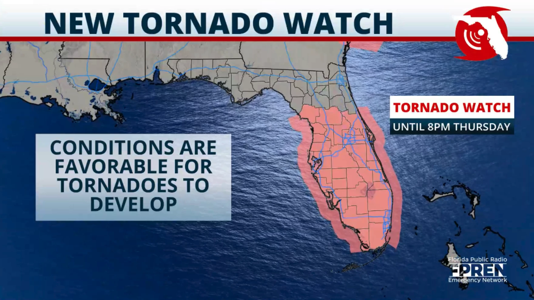
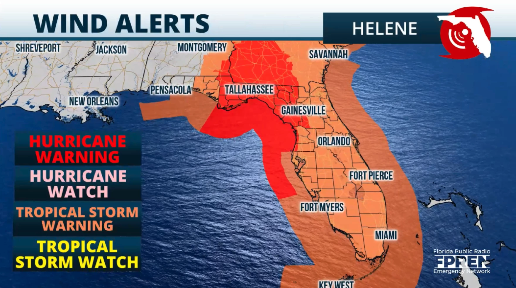
Heavy rainbands have been moving along the Florida Peninsula all evening, and gusty winds have been felt all along the east coast of Florida. Stronger winds will continue to impact the west coast, which will be the (increasing) trend as Helene heads to the Big Bend. Within the rainbands there will be embedded thunderstorms that could develop tornadoes, this is the reason that there is a tornado watch in effect until 8 p.m. Thursday, across much of the Florida Peninsula from Marion County through Miami-Dade County. If you are in a safe structure, stay there until warnings have been canceled for your location. Ensure you have at least 3 ways of receiving weather alerts and keep your mobile devices charged. In case cell towers are down, remember that text messages are the best way to communicate and limit your phone usage to save its power.
Impacts across Florida
Tropical-storm-force gusts will continue along the Southeast, Treasure, and Space Coast. Tropical-storm-force winds, meaning sustained winds, are possible along Southwest Florida and inland Central Florida. Meanwhile, the Central-West Coast could experience winds between 58 and 75 mph. There will be widespread power outages across much of the Florida Panhandle, possibly for several days. Weather will quickly deteriorate on Thursday as the storm nears, and being out will be dangerous.
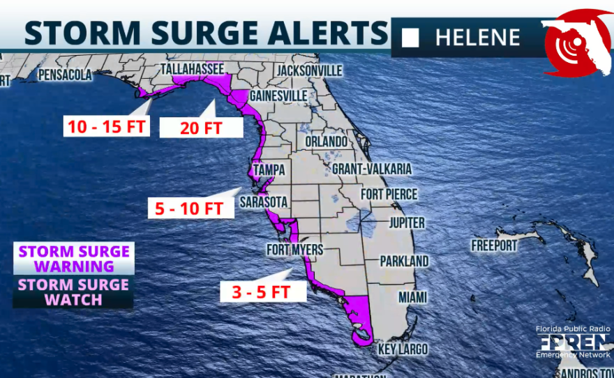
The storm surge along portions of the Big Bend coast will be catastrophic and life-threatening, possibly reaching up to 20 feet. As Helene tracks north, a dangerous and damaging storm surge will affect the entire west coast of Florida.
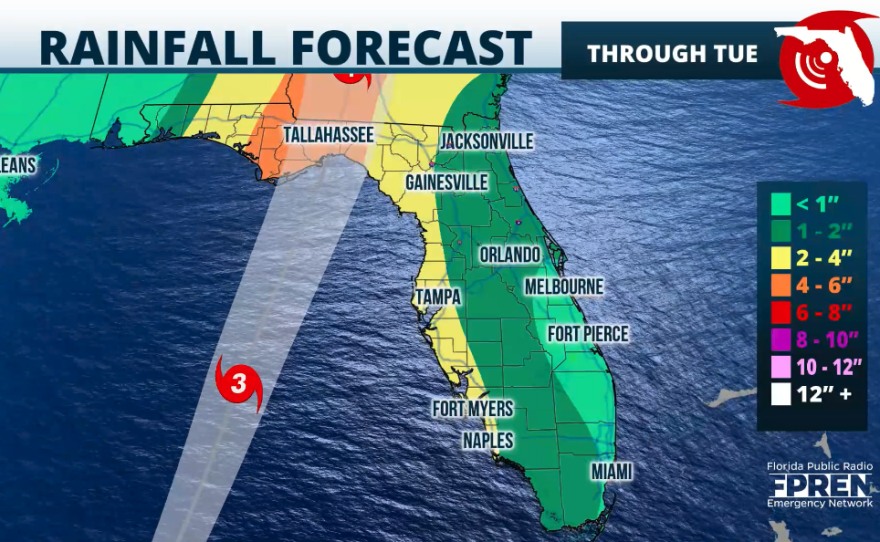
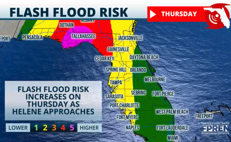
Rainfall will also bring flooding across parts of Florida. August and September have been busy months regarding rain and flooding across parts of Florida´s West Coast. The ground is already well saturated, so the forecast amounts between 2 and 6 inches from Southwest Florida through the Tampa Bay area will cause flooding, possibly even flash floods. Also, rivers, lakes, and creeks will increase their levels, some already high. Flood stages will quickly increase, making conditions dangerous for those nearby.
We will continue to bring you updates throughout the duration of this storm.


