Hurricane And Storm Surge Warnings Issued For The Gulf Ahead Of Zeta
FPREN HQ – Zeta is on course to be the season’s eighth landfalling tropical storm or hurricane this season along the U.S. Gulf coast Wednesday. It made landfall as a category 1 hurricane late Monday evening on Mexico’s Yucatan Peninsula and is emerging in the southern Gulf of Mexico Tuesday morning as a tropical storm.
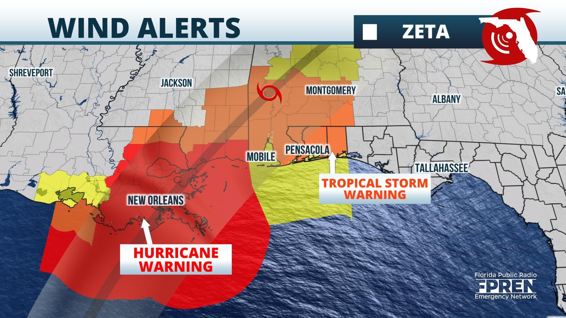
The warm waters of the southern Gulf and weak upper-level winds favor the storm regaining hurricane intensity later Tuesday. A ridge of high pressure over Florida has been steering Zeta toward the northwest, but an approaching trough over the western U.S. is forecast to weaken the ridge and cause the storm to turn toward the north and northeast Wednesday. The center of Zeta is likely to make landfall in southeast Louisiana Wednesday afternoon or evening and then move over Mississippi and Alabama Wednesday night before it reaches the Carolinas on Thursday.
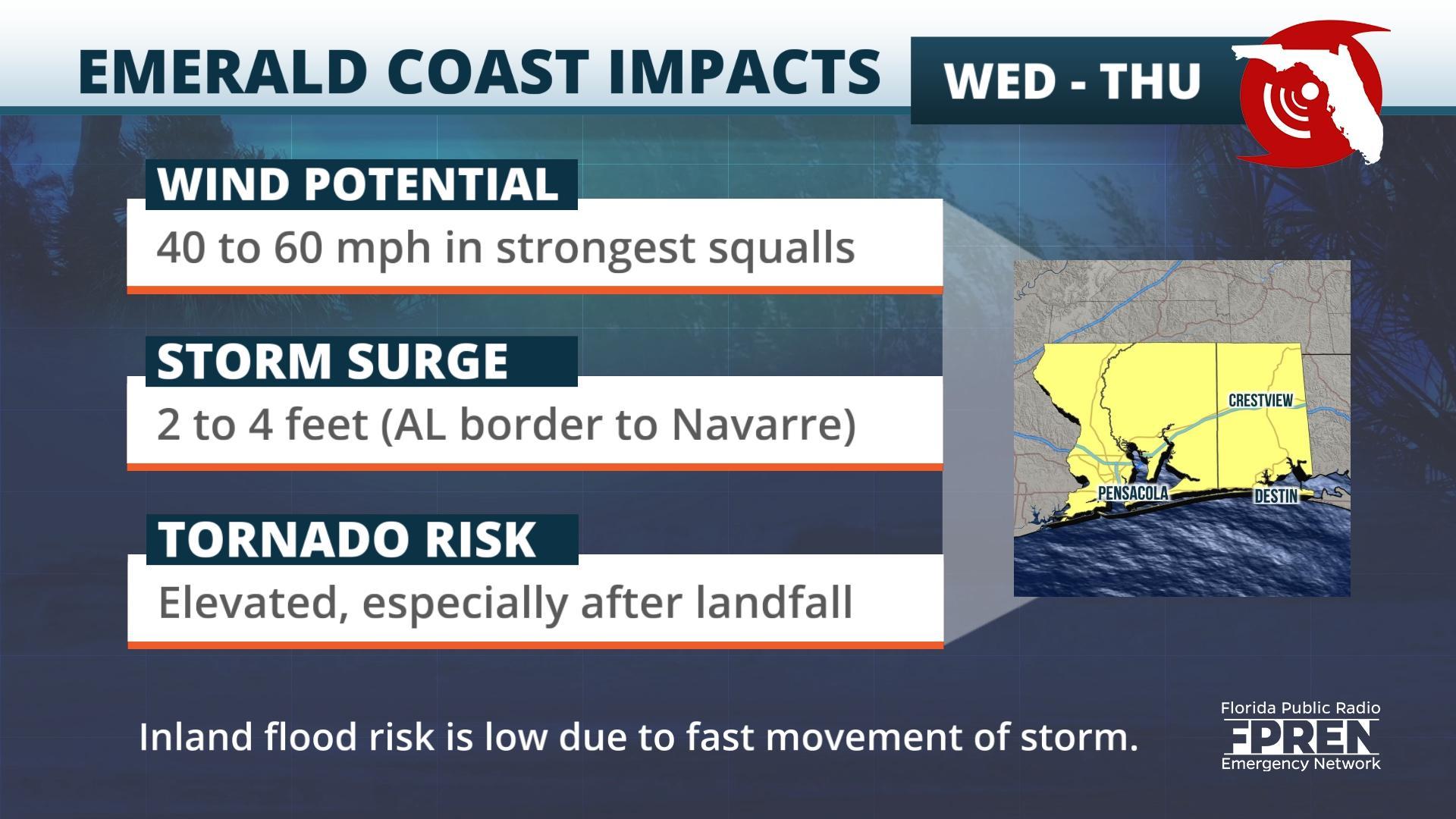
Hurricane Warnings were posted for the Louisiana and Mississippi Gulf coasts, where hurricane conditions are more likely. Tropical Storm Warnings continue for the Alabama Gulf coast to Escambia, Santa Rosa, and Okaloosa counties in the western Florida Panhandle. Tropical storm force winds are likely to arrive in these areas shortly after sunset Wednesday and depart Thursday morning because of Zeta’s fast movement.
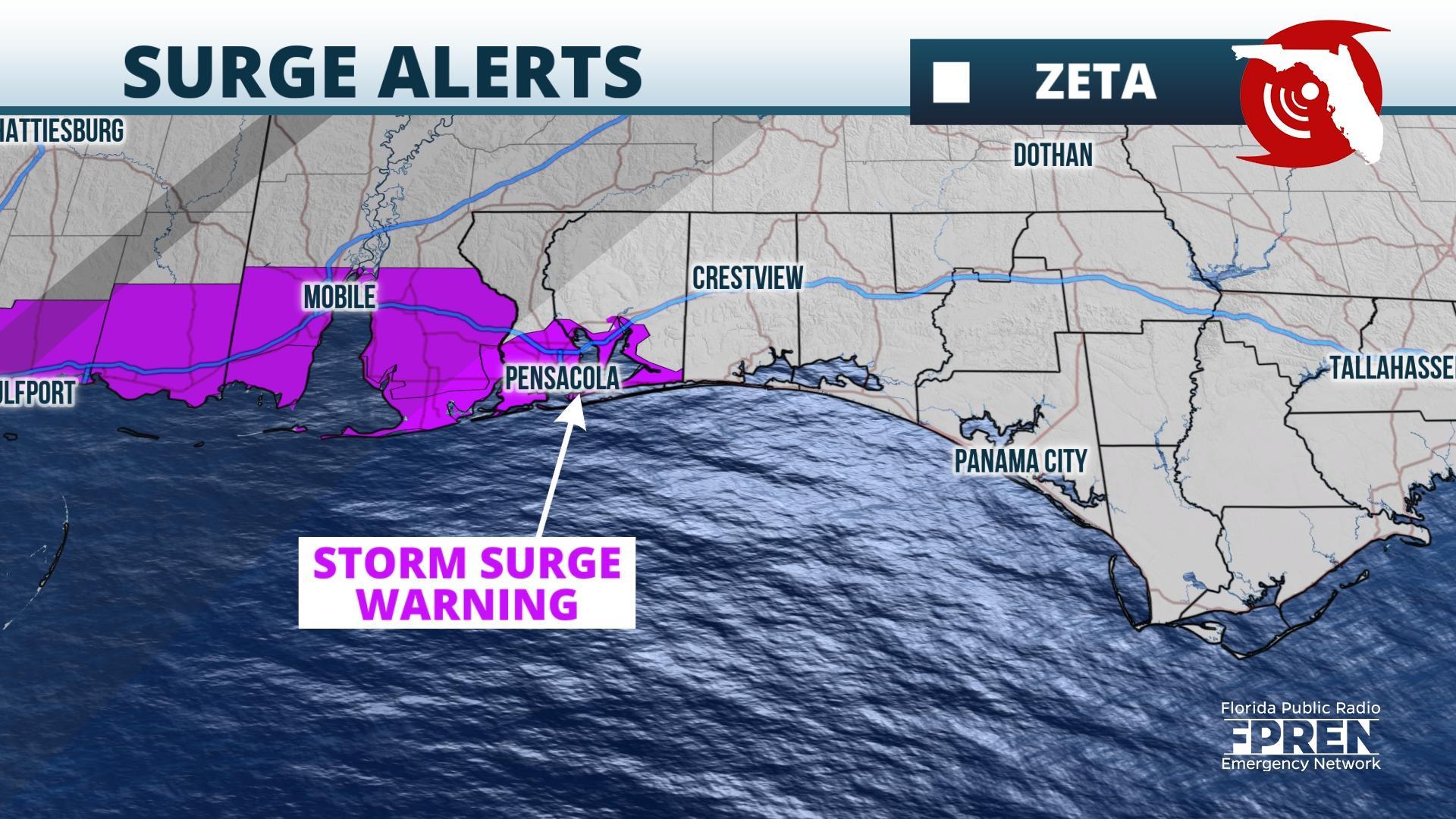
2 to 4 feet of water above normally dry ground is possible from the western Florida Panhandle to Louisiana, with a few places in Louisiana and Mississippi potentially receiving surge of 4 to 6 feet, has prompted Storm Surge Warnings in these areas. Smaller water level rises of 1 to 3 feet above normally dry ground are forecast along the Forgotten and Big Bend coasts, which may cause areas of minor coastal flooding.
Areas of inland freshwater flooding are possible, but flooding is not likely to be as substantial as what occurred with a much slower-moving Hurricane Sally in mid-September. Rainfall amounts of 2 to 4 inches, with locally higher amounts of up to 6 inches, may cause urban, small stream, and minor flooding. The highest rainfall totals are likely in a swath from southeast Louisiana through southern Mississippi, Alabama, the far western Florida Panhandle, north Georgia, and the Upstate of South Carolina into the mountains of North Carolina.
NOAA’s Storm Prediction Center says a few tornadoes are possible starting late Wednesday afternoon into Wednesday night over the western Panhandle in some of the outer rainbands attached to Zeta. This tornado risk could spread into parts of the Florida Big Bend, Georgia, the Upstate of South Carolina, North Carolina, and Virginia during the daylight hours of Thursday.
Weather conditions are likely to improve as soon as early Thursday morning over the western Florida Panhandle, but squally conditions are possible into the Florida Big Bend and the Carolinas on Thursday. The remnant of Zeta is forecast to move into the Atlantic waters Thursday night.
Story by FPREN Meteorologist Jeff Huffman.


