


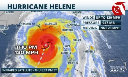
Hurricane Helene stronger, eyewall rebuilding
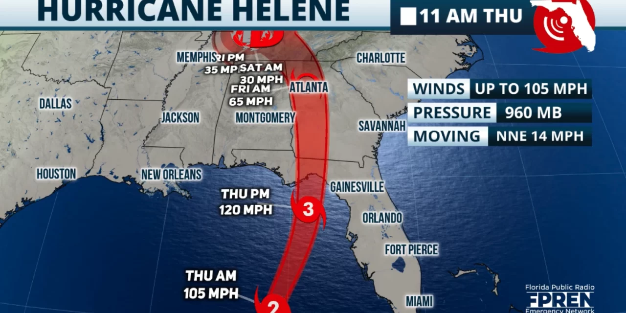
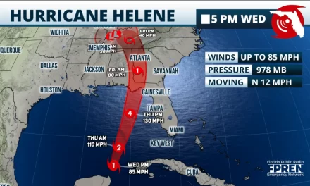
FPREN – Hurricane Helene continues to strengthen as it moves toward the Florida Big Bend. In the 11 a.m. advisory, the National Hurricane Center indicates Helene has maximum sustained winds of 105 mph. It has picked up some speed and is now almost towards the north-northeast at 14 mph. Speed will continue to increase gradually as the Force of this hurricane is also expected to increase.
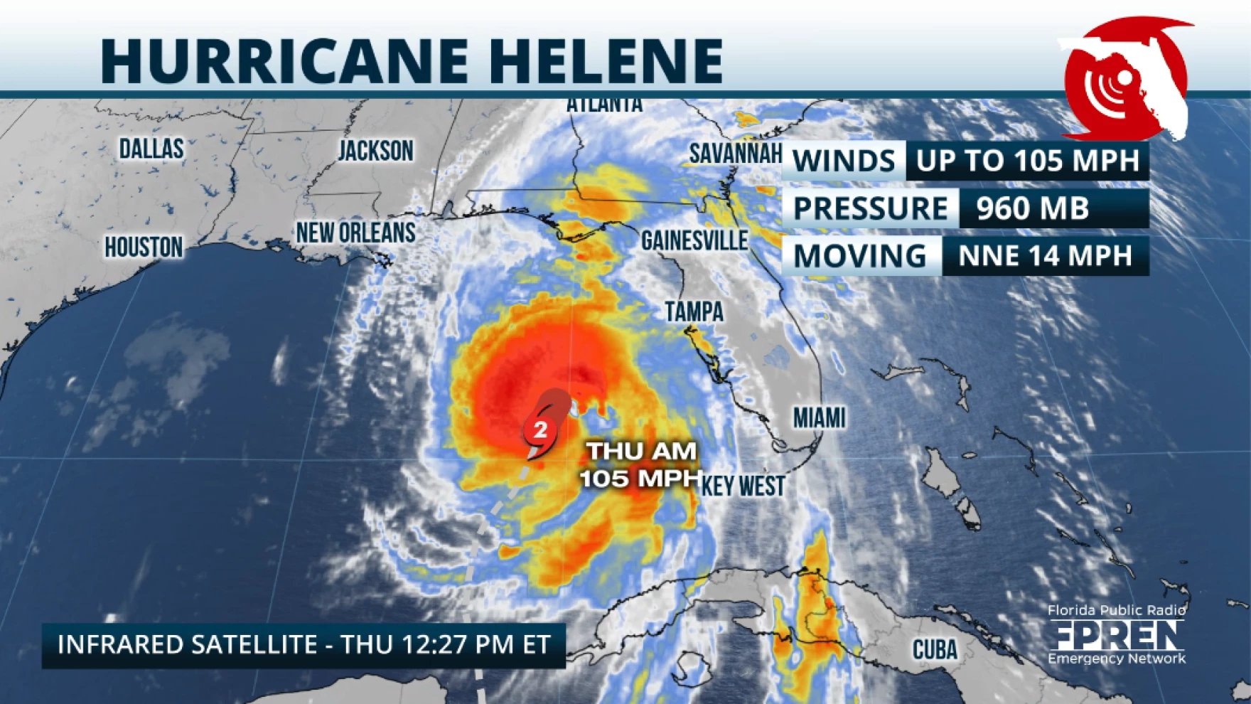
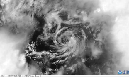
The latest measurements and images taken by the hurricane hunters and satellites indicate that Helene‘s eyewall has expanded and closed off. This is usually a sign of intensification. Helene is already a massive storm with a diameter of over 400 miles.
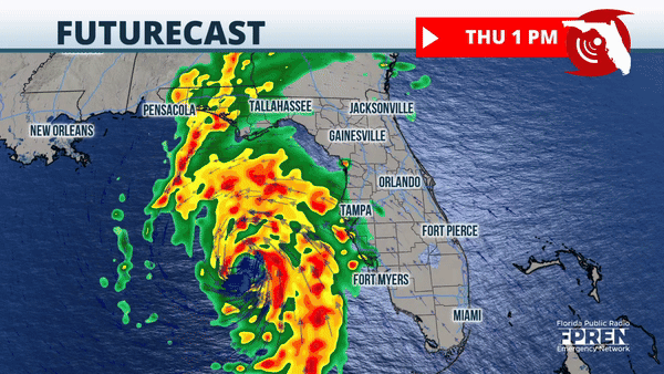
Tropical storm-force winds are experienced across southeast Florida. This means sustained winds between 39 and 57 mph. The West Coast to Florida continues to feel the upper range of tropical-storm-force winds and hurricane-force gusts. The winds will pick up promptly across northern Florida within the next few hours and will continue to become even stronger as the afternoon and evening progresses. Remember, Helene is expected to make landfall on Thursday evening in the Florida Big Bend area. Widespread power outages are very likely across the Florida peninsula and North Florida. Helene’s wind field will continue to expand as the system moves northward.
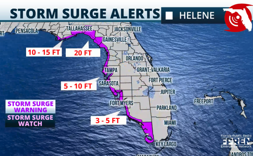
Up to 20 feet of storm surge is still possible across the Big Bend and parts of the Apalachicola area. Up to 8 feet of storm surge is also possible across the west portion of Central Florida.
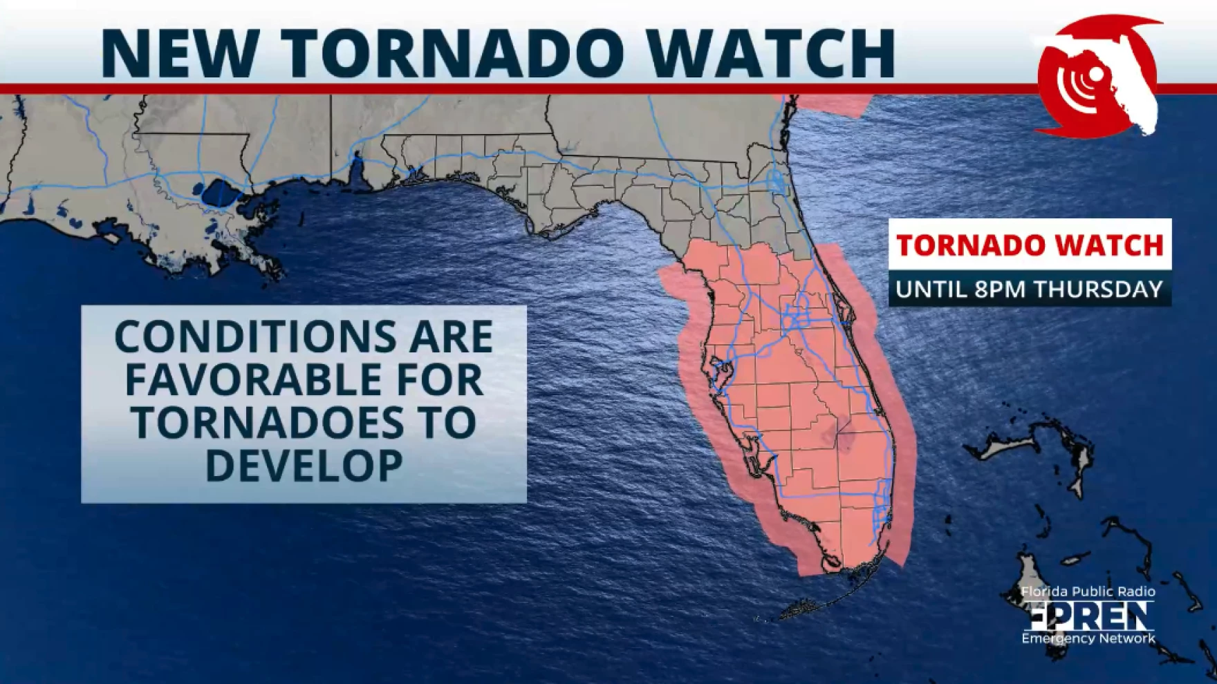
Rainfall will be extensive, especially across the panhandle of north Florida. Flash flooding is possible, especially as Helene inches closer. Heavy rains will continue to move up the state. Some of these heavy rains have had thunderstorms embedded in them, and the National Weather Service has issued several tornado warnings across South Florida and Central Florida on Thursday morning. The tornado watch will continue in effect until 8 p.m. Thursday. Please remain indoors and continue to monitor the weather closely.
Story by FPREN Meteorologist Irene Sans


