


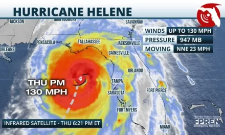
Helene is forecast to be at least category 4 at landfall, T-24 hours
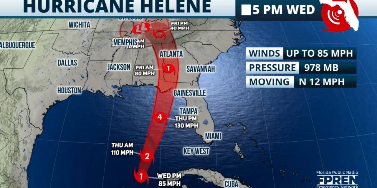
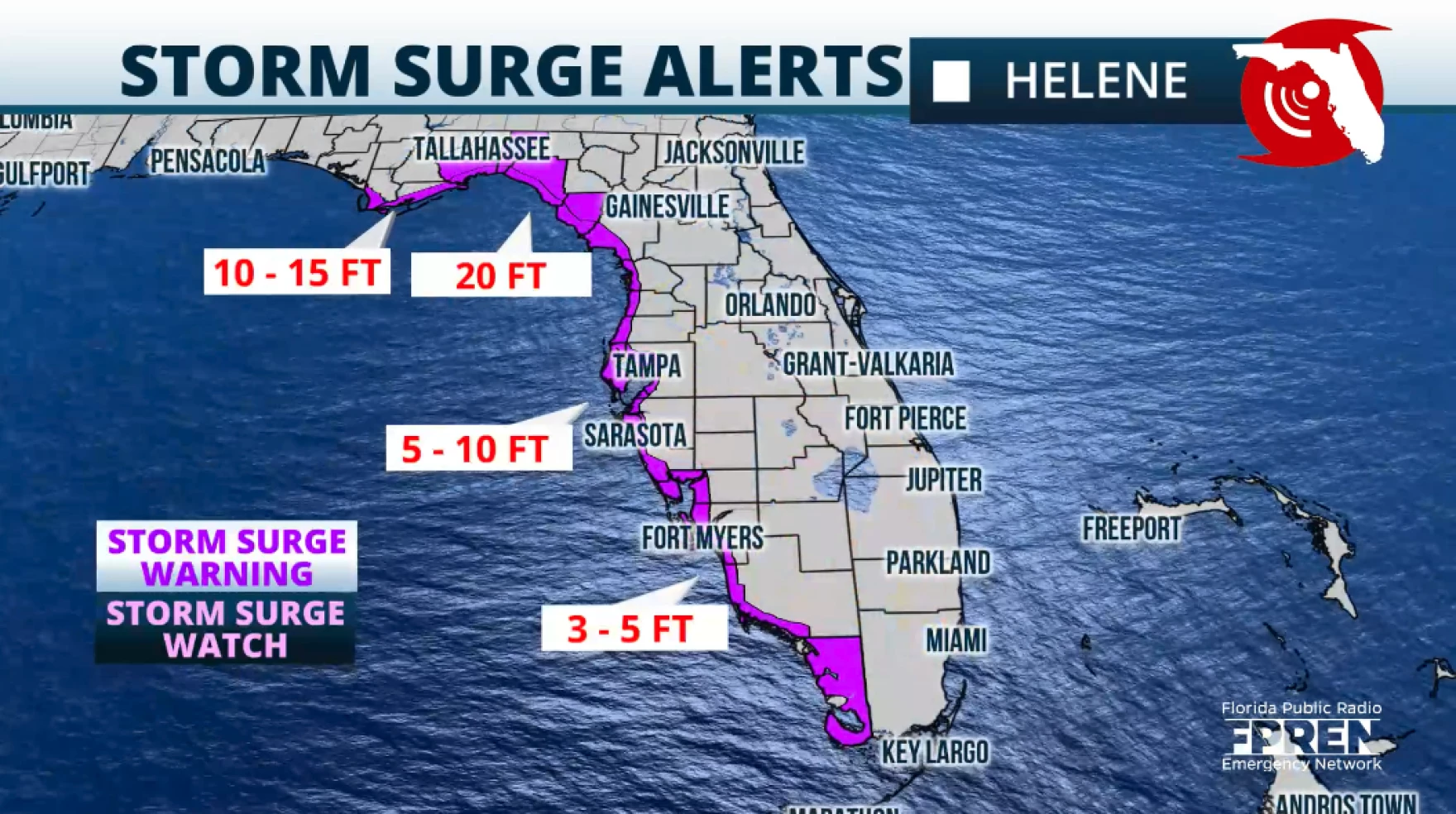
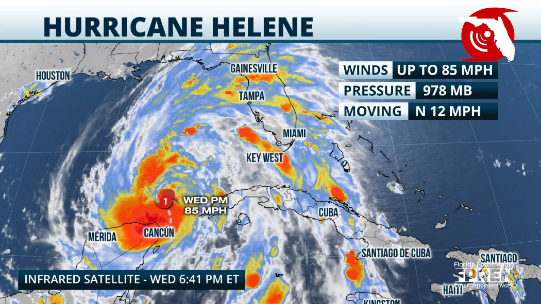
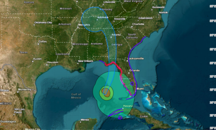
FPREN – The 5 p.m. bulletin from the National Hurricane Center highlights that the storm surge along portions of the Big Bend coast will be catastrophic and deadly, possibly reaching up to 20 feet. Hurricane Helene is likely to become stronger and very fast, with the possibility of reaching category 5 status just before making landfall. The current forecast calls for Helene to reach 140 mph, which would be category 4, but nothing is stopping this system from reaching stronger maximum sustained winds and surpassing the 157 mph threshold, making landfall as a category 5 hurricane, between the Big Bend and Florida Panhandle Coast.
The forecast track shows that Helene could be coming onshore near Eastpoint, west of Carrabelle, then continuing northward, with its center passing about 50 miles west of Tallahassee. This puts Florida´s capital under the strongest winds. There will be widespread power outages across much of the Florida Panhandle, possibly for several days. If you are in this region and not in a safe structure, you should consider evacuating to a safe place tomorrow morning. Weather will quickly deteriorate on Thursday as the storm nears and it will be dangerous to be out.
For the rest of Florida, weather conditions will become more dangerous overnight into Thursday. Heavy and
gusty rainbands will be pushing onto the state, stronger ones on Thursday. Tornadoes will be possible embedded in the rainbands. The Keys have already been dealing with a few storms with tornadic signals, which have triggered tornado warnings. South Florida and Central Florida residents should remain indoors tonight and Thursday as the weather will continue to be dangerous. Tornado risk is moderate across Central and North Florida through late Thursday.
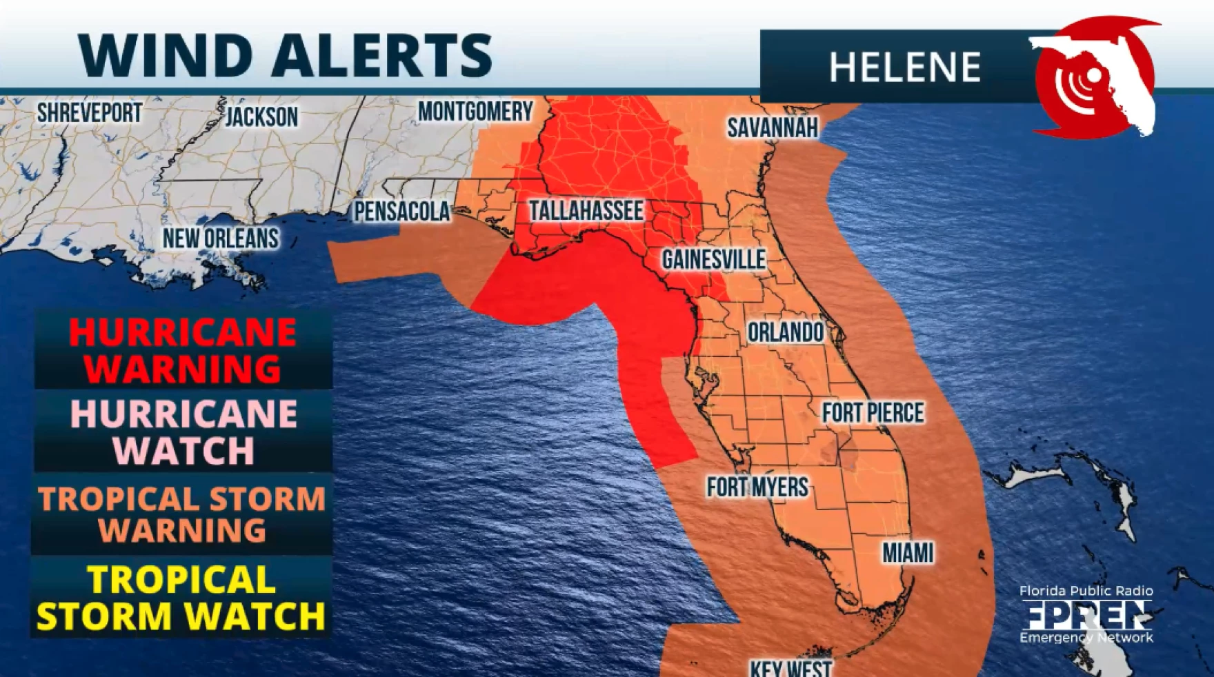
Tropical storm force gusts will be possible along the Southeast Coast, Treasure Coast, and Space Coast. Tropical storm force winds, meaning sustained winds are possible along Southwest Florida, and inland Central Florida. While the Central-West Coast could experience winds between 58 mph to 75 mph.
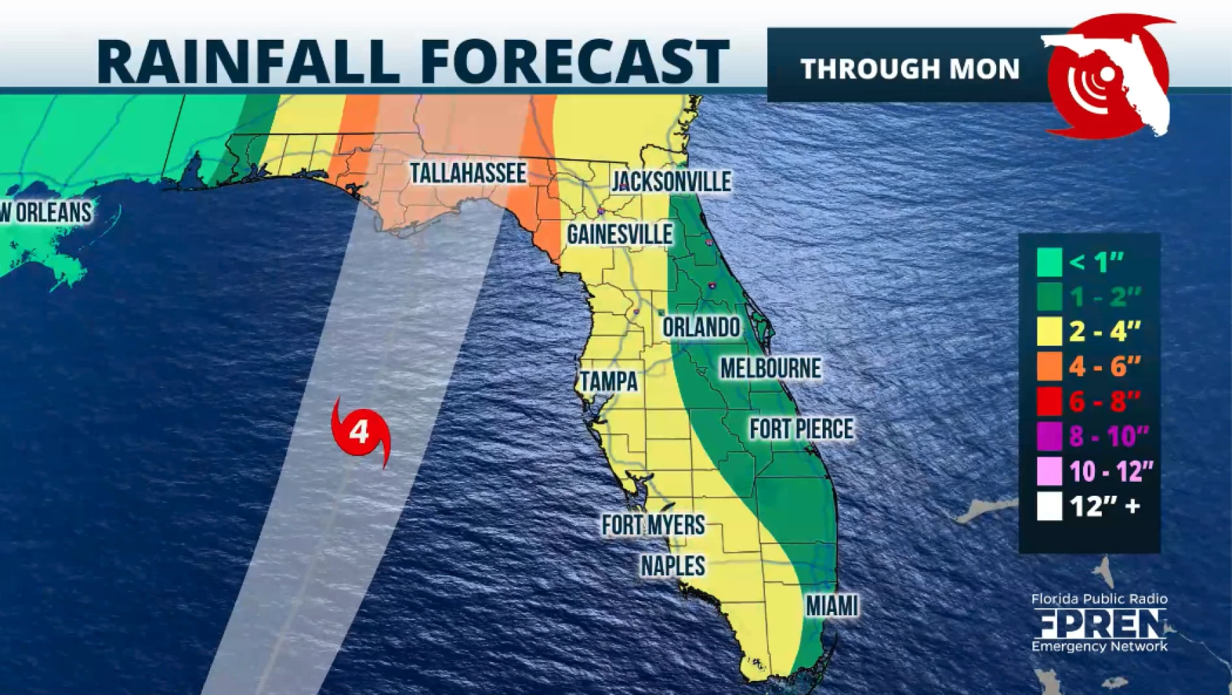
Rainfall will also bring flooding across parts of Florida. August and September have been busy months as far as rain and flooding across parts of Florida´s West Coast. The ground is already well saturated, therefore the forecast amounts between 2 and 6 inches from Southwest Florida through the Tampa Bay area, will be causing flooding, possibly even flash floods. Also, rivers, lakes, and creeks will increase their levels, some of which are already high. Flood stages will quickly increase, making conditions dangerous for those nearby.
Please make sure you heed the authorities’ orders. If you are asked to evacuate, please so do. Each storm is different and this one will bring life-threatening weather conditions that will go well beyond the center. If you are in a safe structure, stay there until warnings have been canceled for your location.
Make sure to have at least 3 ways of receiving weather alerts and keep your mobile devices charged. In case cell towers are down, remember that text messages are the best way to communicate and limit your phone usage to save its power.
Story by FPREN Meteorologist Irene Sans


