Updated Outlook – Strong El Niño This Winter
NOAA releases updated weather outlook; strong El Niño event expected
The Climate Prediction Center’s updated weather outlook indicates a slightly increased confidence of a strong El Niño event by this winter.
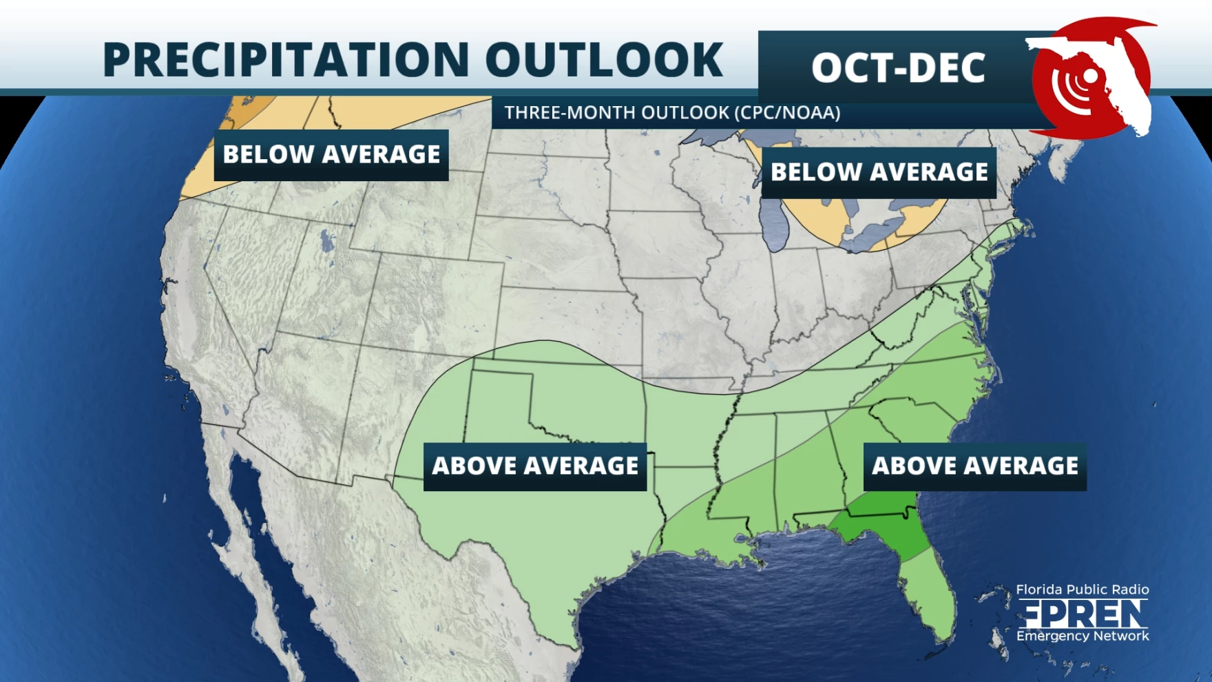
This could mean more wet weather for the Southeast region of the U.S. The forecast is based on observed and predicted sea surface temperatures.
“These conditions are reflected in current observations as well as greater forecast confidence,” Regional Climatologist Chris Fuhrmann said. “It’s also worth noting that the chance of a very strong El Niño, one on par with some the biggest events of the past 75 years, is now around 30%.”
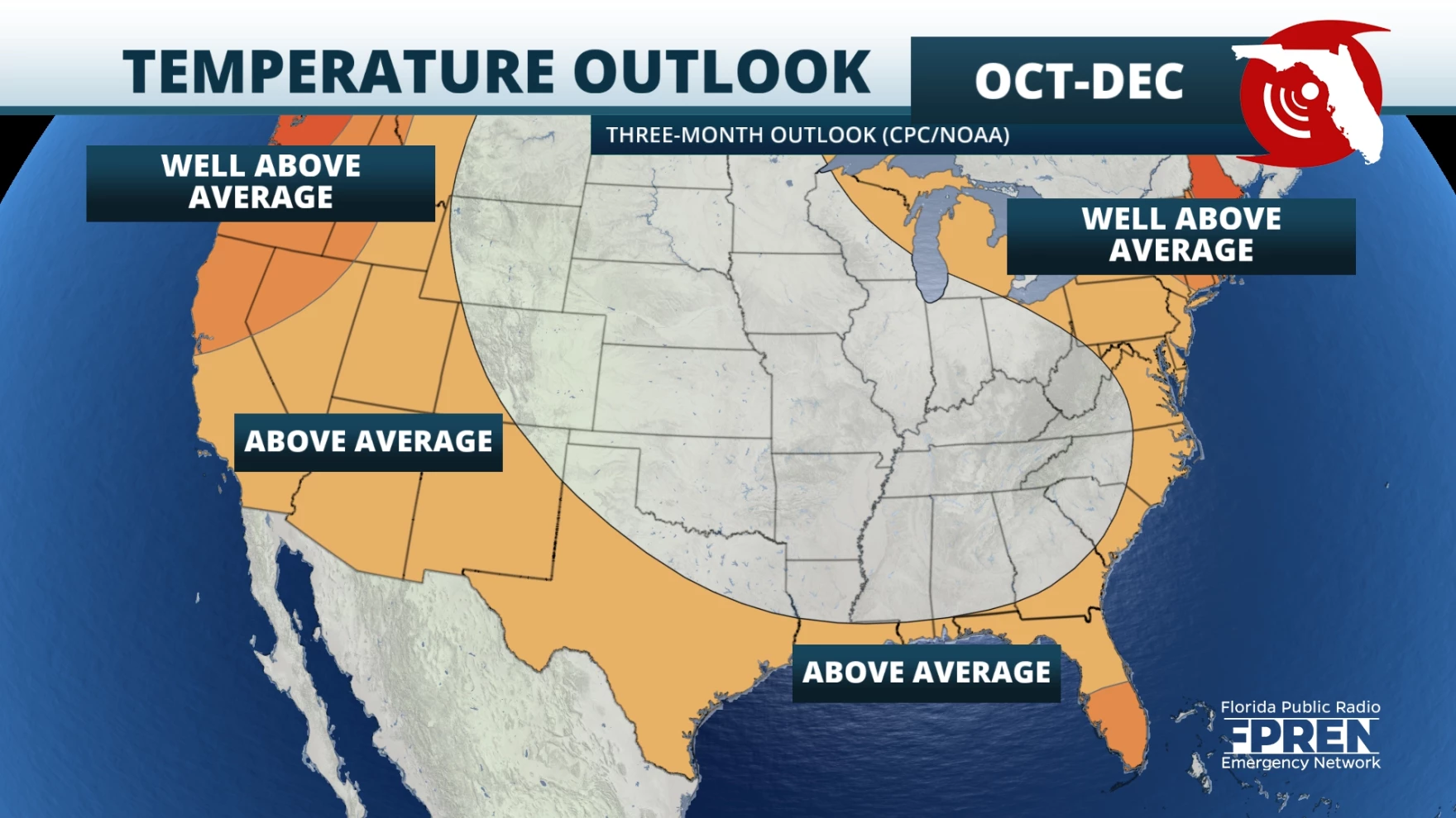
A strong El Niño can cause a range of impacts, including heavy rainfall and drought conditions around the world. This could bring new temperature records for the Southeast portion of the U.S., which has already experienced above-average temperatures this summer.
El Niño is a natural climate phenomenon marked by warmer-than-average sea surface temperatures in the central and eastern Pacific Ocean, near the equator, but its effects extend well beyond the Pacific Ocean.
The event can occur every two to seven years and can last up to 12 months, according to the National Oceanic and Atmospheric Administration.
Looking at precipitation and temperature
Fuhrmann explains that it has been “a tale of two temperature patterns this summer across the region.”
Florida, southern portions of Alabama and Georgia and the Caribbean were tied for their warmest summer on record, while temperatures in places like upstate South Carolina and western portions of North Carolina and Virginia recorded below-average temperatures this summer.
Much of the region was drier than average over the past month, except in places that were affected by tropical cyclones. The Big Bend region of Florida and portions of Georgia and the Carolinas received five to 10 inches of rain because of Hurricane Idalia.
Above-average temperatures are continuing to be recorded across the U.S. Southeast. For the next three months, the Climate Prediction Center is forecasting above-average temperatures across Florida and along the northern Gulf and Atlantic coasts.
Precipitation is projected to be above average for the entire U.S. Southeast.
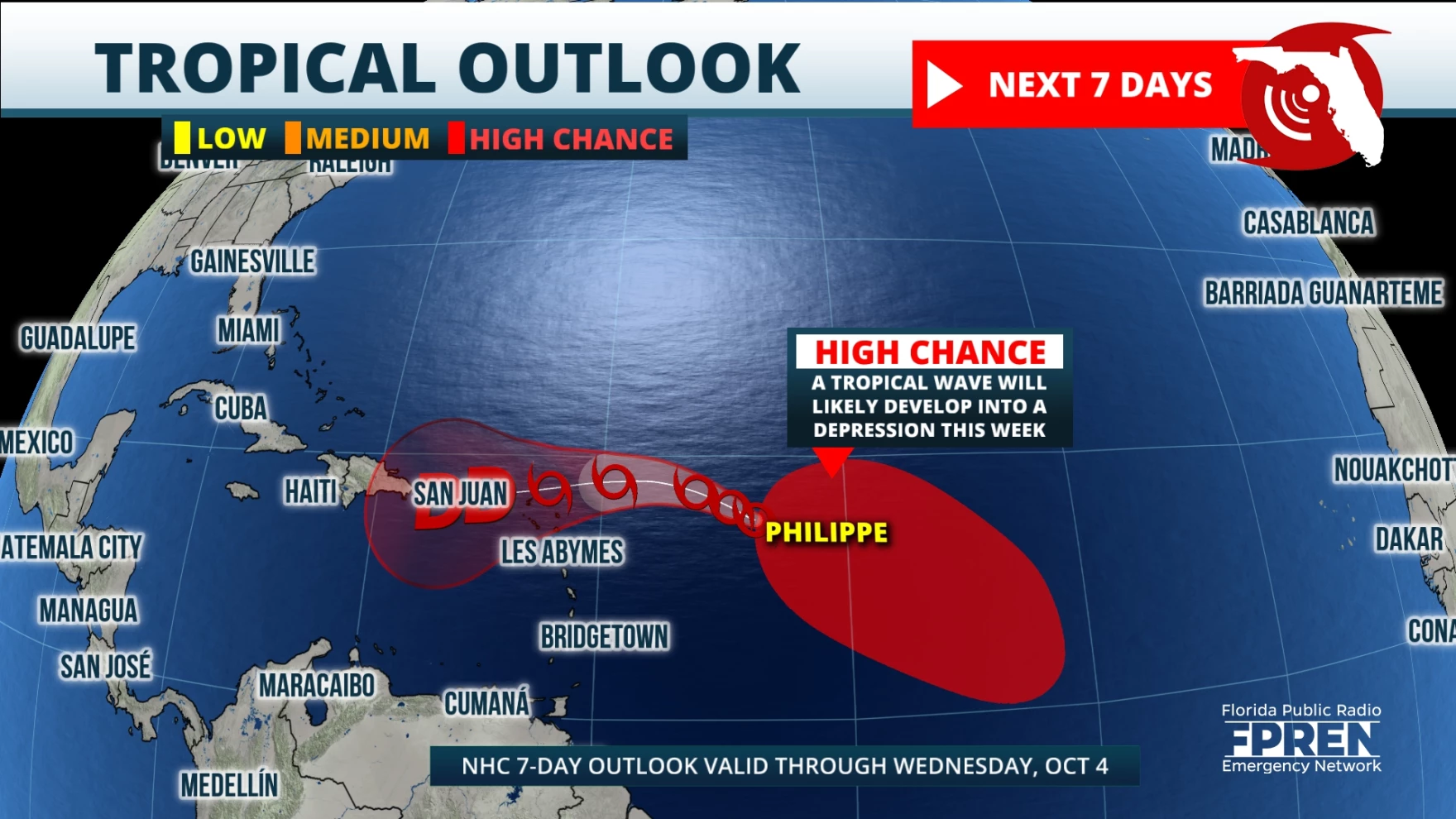
The National Hurricane Center continues to monitor Tropical Storm Philippe, now moving west at 9 mph with 50 mph winds. Philippe is expected to track to the west-northwest over the next several days and is not expected to strengthen. It may bring some rain to Puerto Rico and the U.S. Virgin Islands. Tropical-storm-force winds extend outward up to 205 miles from the center.
Showers and thunderstorms associated with the tropical wave in the Central Tropical Atlantic are expected to develop into a tropical depression over the next few days while the system moves west northwestward.
Continue to monitor local conditions and keep an eye on the tropics as we move through hurricane season.
Angela Small
Radio Production Assistant


