NHC Forecasting Idalia to Hit Florida as a Hurricane This Week
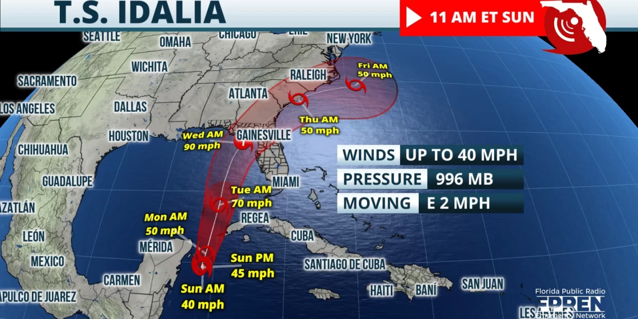
FPREN HQ – Tropical Depression Ten has now intensified into Tropical Storm Idalia. The NHC is forecasting landfall as a Category 1 hurricane (winds up to 90 mph) along the Florida Gulf Coast on Wednesday. A slightly weaker or stronger storm cannot be ruled out since we are early in the storm’s evolution and there is very little aircraft data. Also, the storm is heading farther south than expected this morning which may throw off landfall timing. So as always, we are encouraging everyone to check back often since changes in the timing, intensity, and track are likely.
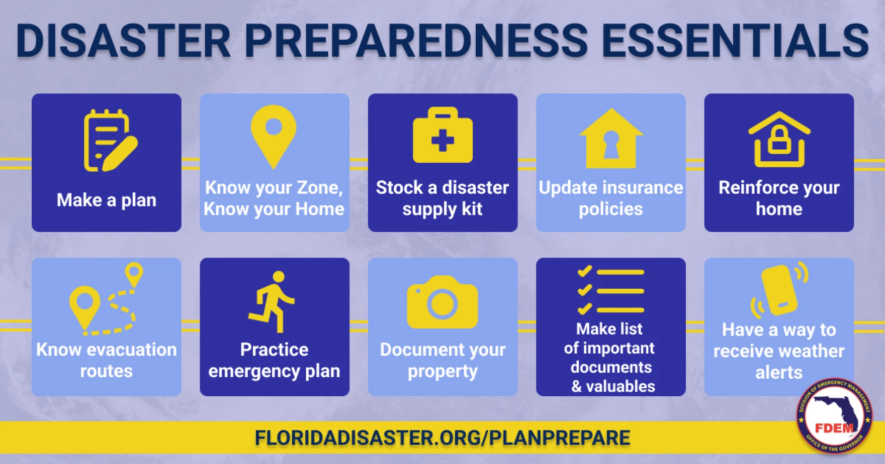
Residents are encouraged to start preps today, and to be careful due to the high heat. For now, tropical storm conditions are expected to start hitting the Gulf Coast on Tuesday, so preps need to be completed by Monday evening. At minimum today, we should be practicing our plan and topping off supplies. For more on building a disaster plan and preparing emergency kits, go to: https://www.floridadisaster.org/planprepare/
Please keep in mind impacts will be felt well outside the cone so everyone along the Gulf Coast needs to make preparations. The cone should only be used to identify the forecasted path of the storm, which now has a lot of uncertainty. Impacts inside and outside the cone include high winds, flooding rains, coastal storm surge, and isolated tornadoes.
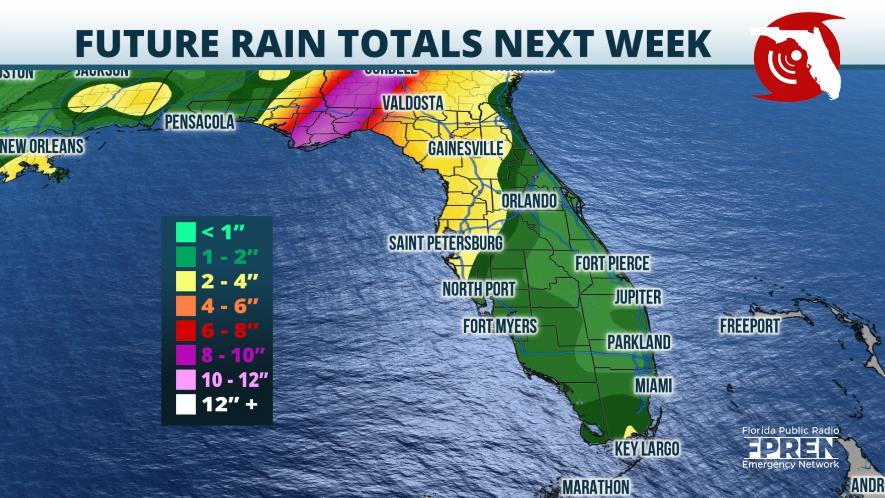
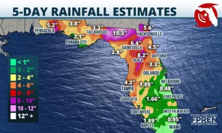
Based on Idalia’s current track, areas closest to the path can expect 3-6”of rain on average, and locally up to 10”+. Areas well inland across the Panhandle and Peninsula could possibly receive 2-5” of rain with locally higher amounts. Storm surge forecast maps have not been posted yet but most areas along the Gulf can expect inundations in the 1–4-foot range with a Category 1 hurricane. But the Big Bend Coast is much more susceptible and will need to plan for inundations possibly up to 10 feet.
It’s important to remember that most tropical cyclone-related fatalities are due to the high waters caused by flooding and storm surge. Consider the following advice: hide from the wind, run from the water. As timing would have it, a supermoon Tuesday into Wednesday may increase the coastal flooding and storm surge threats.
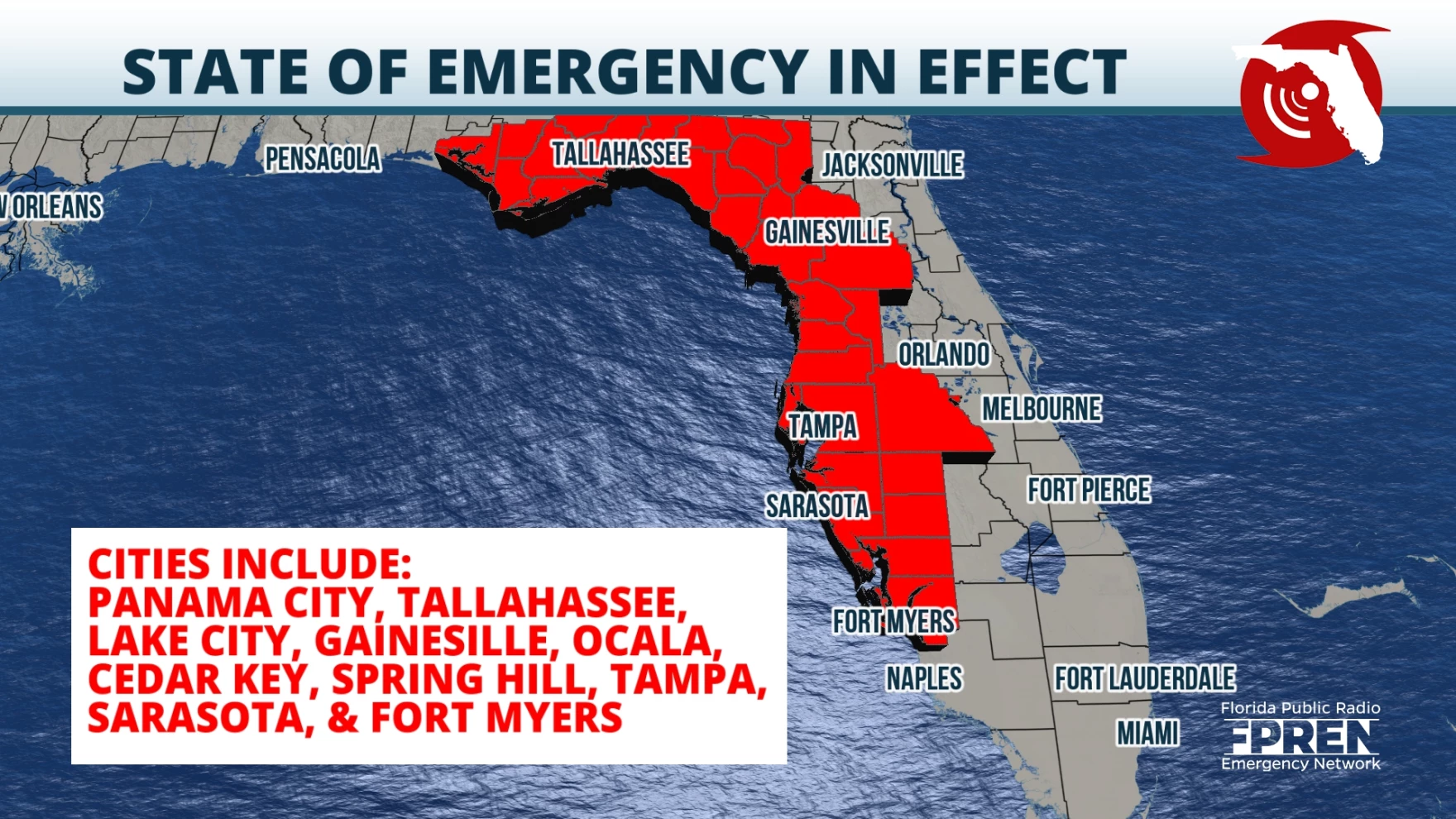
A State of Emergency was declared yesterday for 33 of Florida’s 67 counties. Governor DeSantis, who signed an Executive Order on Saturday to declare the state of emergency, said that although impacts aren’t forecasted for the state until next week, the declaration will allow families and communities to prepare.
Residents are highly encouraged to plan for the worst, hope for the best, and check the forecast at least twice a day. Those who are well-prepared have peace of mind and little reason to panic. Download the Florida Storms app to keep you safe and informed at all times.
Story by Chief Meteorologist Jeff George of FPREN.


