First Batch Of Stormy Weather Likely Thursday; More To Follow This Weekend
Gainesville, Florida – The tranquil weather pattern that has lasted nearly a week over the Florida Panhandle is expected to change toward a stormier, more unsettled one starting Thursday.
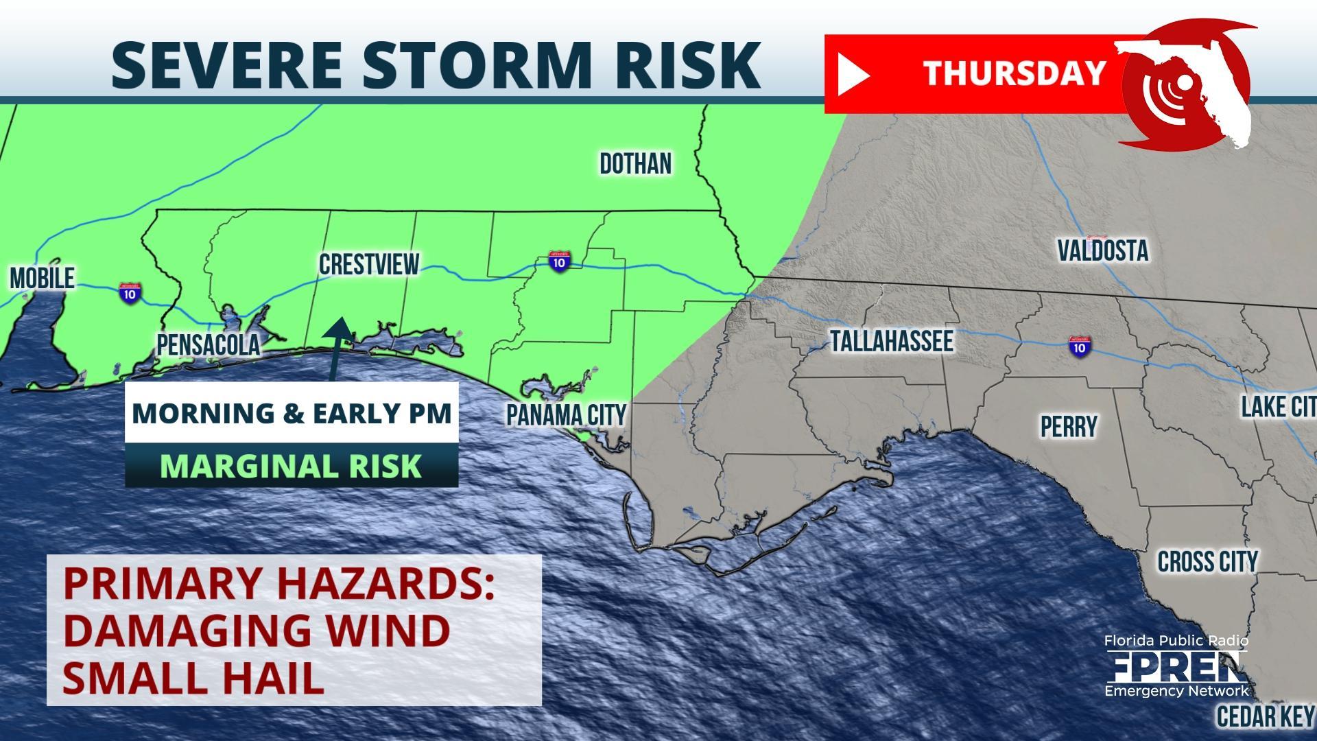
A strong high pressure ridge over the Florida Peninsula is moving offshore and giving way to an approaching storm over the Central and Southern Plains. An influx of warmer and more humid air from the Gulf is likely to support a band of thunderstorms over the western Florida Panhandle, along the southern edge of the storm in the Midwest. These storms are likely to affect areas near Pensacola, Fort Walton, Destin, and Crestview during the early and mid-morning hours of Thursday. They are expected to move east and reach the Panama City and Marianna area during the midday hours. A few of the stronger storms may produce strong wind gusts and hail as they move through.
The storms are forecast to weaken as they approach the Tallahassee area later Thursday. The main storm system will move to the western Great Lakes area, becoming increasingly removed from the warm, humid, and unstable air from the Gulf, which should cause the weakening trend.
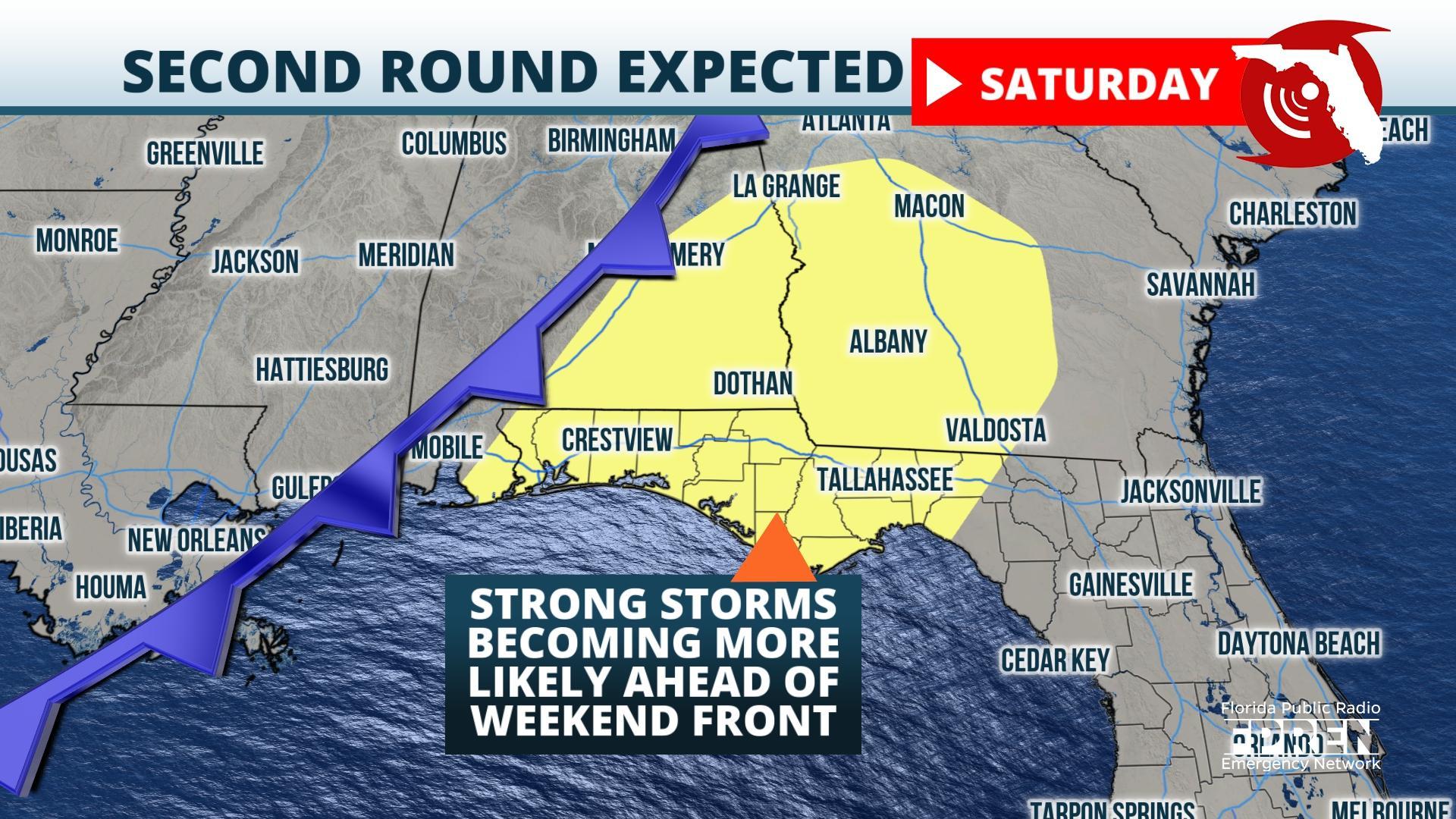
Thursday will not be the only opportunity for thunderstorms in the Panhandle. Another storm system is on track to move over the Rockies and extend from the Midwest to the Gulf coast Friday night into Saturday. Computer model simulations are strongly suggesting the overall weather pattern will favor a cluster of strong to severe thunderstorms moving through between late Friday night and Saturday afternoon. More than 3 inches of rain are likely in the coming days over the Panhandle, which introduces some threat for flash flooding. Residents are encouraged to monitor the forecasters for updates heading into the upcoming weekend.
Story by FPREN Meteorologist Ray Hawthorne.


