Tropical System May Bring Wet Weekend to Florida
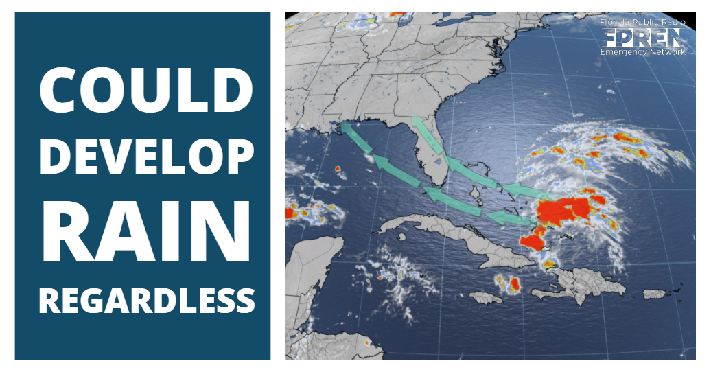
FPREN HQ – A tropical wave moving through the southeastern Bahamas is likely to bring rain to parts of Florida this weekend, but there is an increasing chance it will become a tropical depression or tropical storm as it does so.
The tropical wave is expected to move toward the west-northwest along the periphery of a strong high pressure ridge that has been responsible for a stretch of dry, hot weather over the Southern United States in recent days. Strong westerly wind shear and dry air are the primary reasons why the tropical wave is unlikely to develop over the next 2 days.
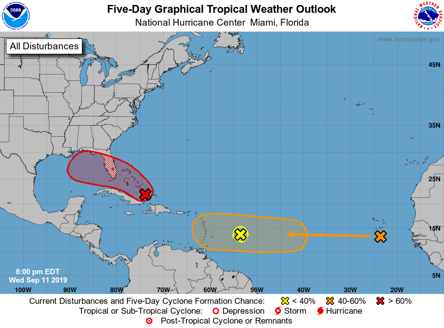
The upper air environment is forecast to become somewhat more favorable for the tropical wave to strengthen over the weekend. An upper-level low pressure area in the eastern Gulf — which is imparting the wind shear — is forecast to weaken and move into the western Gulf. A ridge of high pressure is more likely to build over the tropical wave, reducing the wind shear. The National Hurricane Center forecast as of midday Wednesday has a 60% chance of development this weekend over the eastern Gulf of Mexico.
The forecast models have a variety of possible forecast tracks for this tropical wave. The global model suite run in the United States — called the Global Forecast System, or GFS for short — project a depression or tropical storm to head more toward the central Gulf coast. If this is correct, there would be a greater chance of rain in the Big Bend and Panhandle where pockets of moderate drought have developed according to the latest Drought Monitor. Meanwhile, the European global model — called the ECMWF — and its ensemble suite show also suggest a depression or tropical storm tracking over the far eastern Gulf. Such a path would favor more rain over the Peninsula and Big Bend areas and less over the western Florida Panhandle. These differences in the models are not uncommon, especially in the development phase of a tropical cyclone.
Regardless of whether a tropical depression or storm forms, heavy showers are forecast to increase, especially Friday night and Saturday over the Florida Peninsula. Depending on the track of the tropical system, these showers may reach the Panhandle and Big Bend Saturday night or Sunday. The latest official forecast from NOAA’s Weather Prediction Center shows 1 to 3 inches of rain over parts of the state, but that is subject to change pending the track of the tropical disturbance.


