Dorian expected to rapidly intensify, posing serious threat to Florida
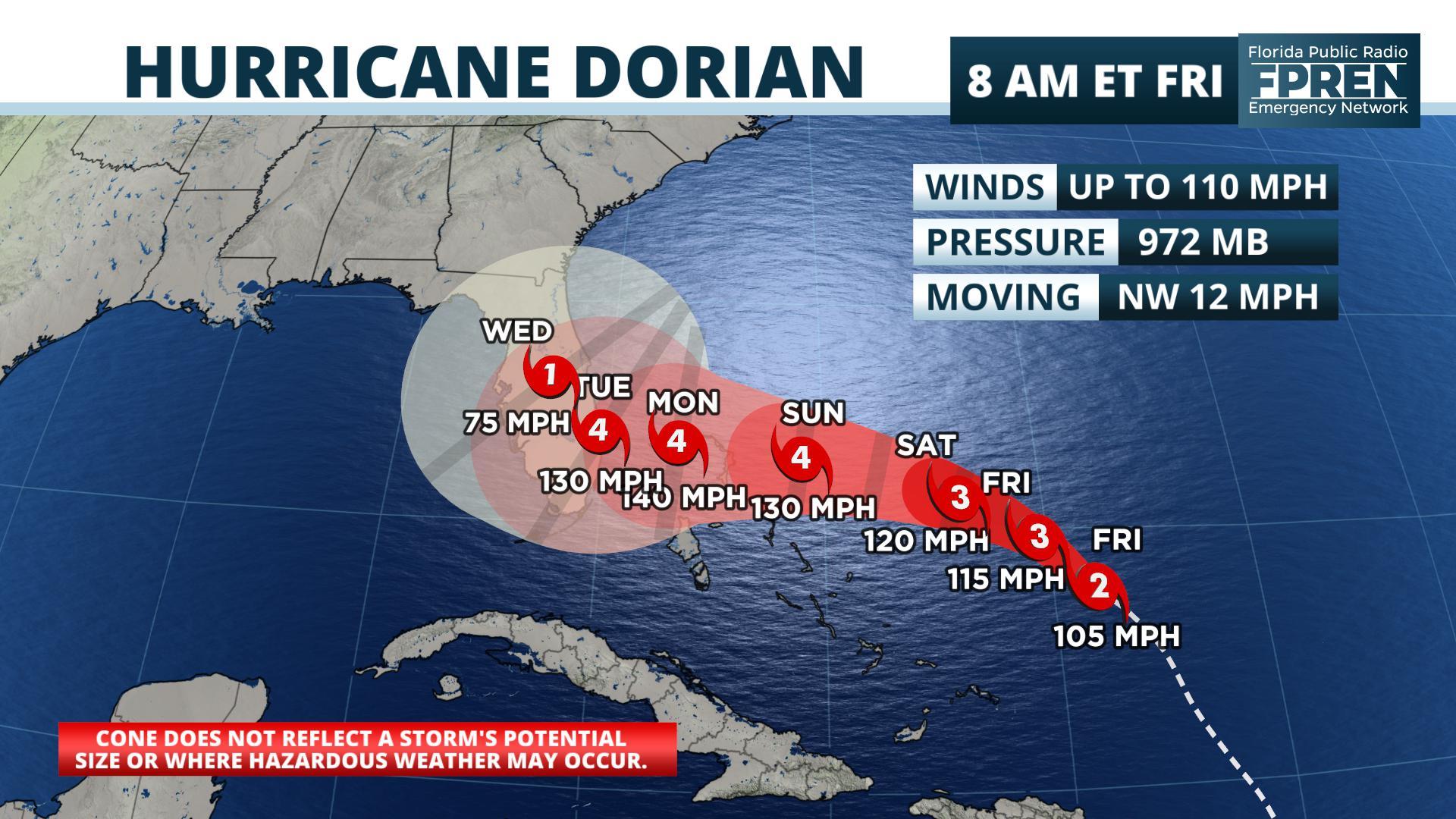
FPREN HQ – Dorian strengthened to a category 2 storm Thursday night and forecasters say it’s expected to become a powerful category 4 hurricane this weekend as it draws closer to Florida.
The government of the Bahamas issued a Hurricane Watch for the northwestern Bahamas in advance of the hurricane’s arrival there Sunday and Sunday night.
A high pressure ridge over the Mid Atlantic states is forecast to turn Dorian westward toward Florida, but there are signs the ridge will weaken late Sunday and Monday. This will cause the hurricane to slow down its forward motion as it approaches the east coast of Florida. The latest forecast calls for the storm to most likely make landfall late Monday night, but its first outer bands may arrive on Sunday on the coast with tropical storm force winds.
The highest probability of tropical storm and hurricane force winds as of the latest update from the National Hurricane Center are in Martin and Palm Beach counties. However, the chances of these winds are almost as high from the upper Keys to the Daytona Beach area. The forecast cone continues to cover much of the Florida peninsula.
The storm’s slow motion means that many locations will receive surge, strong winds, and torrential rain for many hours. If Dorian moves inland, fresh water flooding and tropical storm force winds will become serious threats. These hazards may last into Tuesday and perhaps Wednesday in parts of the state, particularly the peninsula.


