Tropical Storm Dorian Forms in Atlantic
Panama City, Florida – Tropical Depression Five has been upgraded to Tropical Storm Dorian by National Hurricane Center this afternoon. Dorian is no immediate threat to Florida, but long range forecast data suggests it could move in the general direction of the northern Caribbean or southeastern United States in about a week.
It is far too soon to credibly predict how strong it may be at that time or where specifically it would track.
Key Messages from the National Hurricane Center advisory:
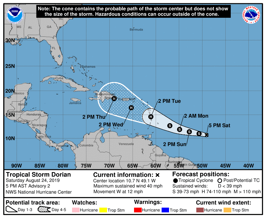
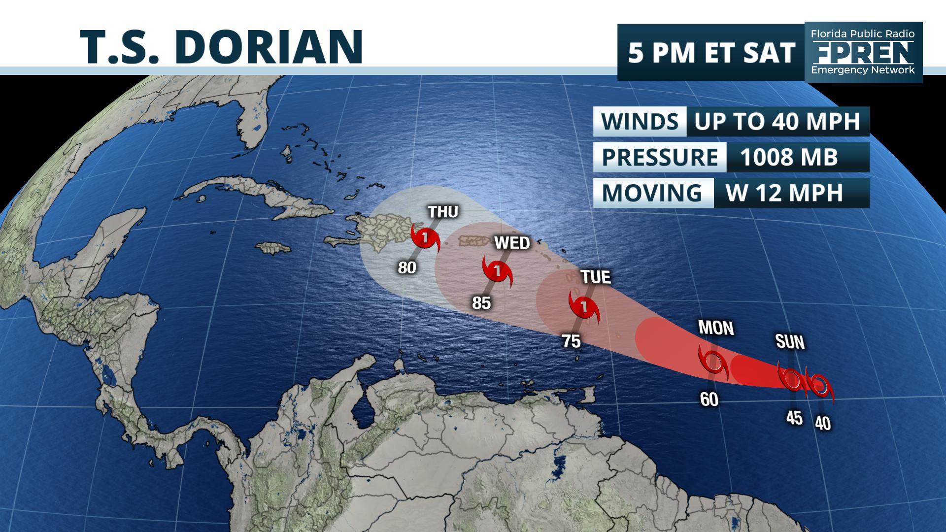
1. Dorian is forecast to strengthen and could be near hurricane strength when it approaches the Lesser Antilles on Tuesday.
2. It is too soon to determine the specific timing or magnitude of impacts in the Lesser Antilles, but tropical storm or hurricane watches may be needed for a portion of the area on Sunday.
National Hurricane Center
Tropical Storm Dorian Advisory Number 2
Tropical Storm Dorian Advisory Number 2
NWS National Hurricane Center Miami FL AL052019
500 PM AST Sat Aug 24 2019
…DEPRESSION STRENGTHENS INTO THE FOURTH TROPICAL STORM OF THE
2019 ATLANTIC HURRICANE SEASON…
SUMMARY OF 500 PM AST…2100 UTC…INFORMATION
———————————————-
LOCATION…10.7N 49.1W
ABOUT 725 MI…1165 KM ESE OF BARBADOS
MAXIMUM SUSTAINED WINDS…40 MPH…65 KM/H
PRESENT MOVEMENT…W OR 280 DEGREES AT 12 MPH…19 KM/H
MINIMUM CENTRAL PRESSURE…1008 MB…29.77 INCHES
WATCHES AND WARNINGS
——————–
There are no coastal watches or warnings in effect.
Interests in the central and northern Lesser Antilles should
monitor the progress of Dorian.
DISCUSSION AND OUTLOOK
———————-
At 500 PM AST (2100 UTC), the center of Tropical Storm Dorian was
located near latitude 10.7 North, longitude 49.1 West. Dorian is
moving toward the west near 12 mph (19 km/h) and this general
motion is expected to continue tonight. A turn toward the
west-northwest is forecast on Sunday, and that motion is expected
to continue through Tuesday. On the forecast track, the tropical
cyclone is expected to be near the central Lesser Antilles on
Tuesday.
Maximum sustained winds have increased to near 40 mph (65 km/h) with
higher gusts. Gradual strengthening is forecast during the next few
days, and Dorian could be near hurricane strength when it
approaches the central Lesser Antilles on Tuesday.
Tropical-storm-force winds extend outward up to 25 miles (35 km)
from the center.
The estimated minimum central pressure is 1008 mb (29.77 inches).
HAZARDS AFFECTING LAND
———————-
None.
NEXT ADVISORY
————-
Next complete advisory at 1100 PM AST.
$$
Forecaster Stewart
Stay tuned to WKGC Storm Center, as Florida Public Radio Emergency Network (FPREN) will have the latest. Remember, WKGC is the only FPREN station in the central Florida Panhandle.


