Tropical Storm Barry Strengthening as it Approaches Louisiana
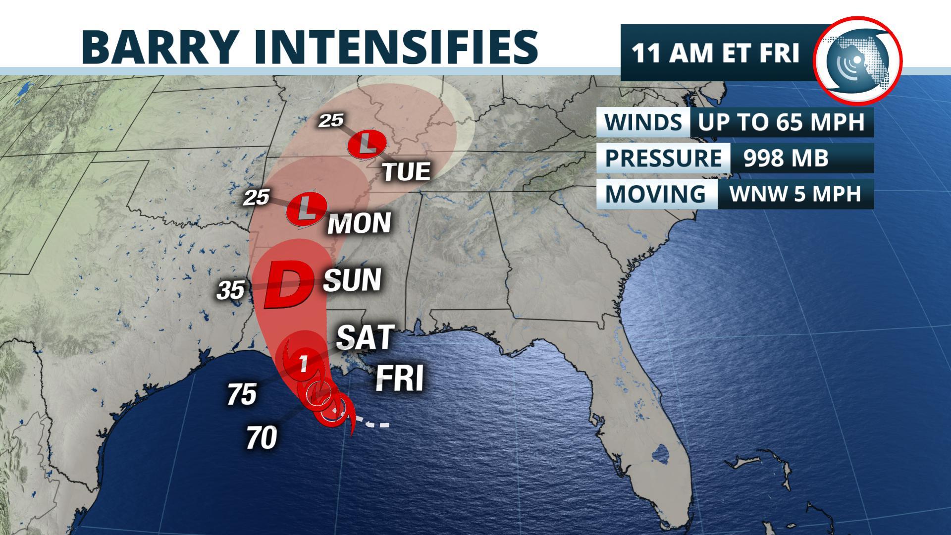
Gainesville, Florida – Tropical Storm Barry is intensifying as it moves slowly toward the Louisiana Gulf coast.
Barry was located 100 miles southwest of the mouth of the Mississippi River, according to the advisory issued by the National Hurricane Center at 11 am Friday. The warm waters of the Gulf of Mexico should encourage the system to intensify, but dry air high above the storm and wind shear have prevented rapid strengthening so far. Forecasters expect Barry to be near hurricane intensity as it makes landfall Saturday morning.
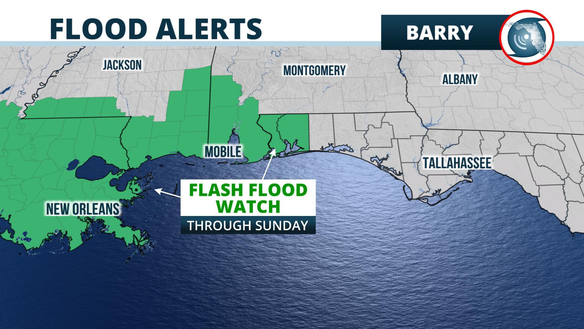
Meteorologists at the National Hurricane Center say 3 to 6 feet of storm surge is possible along the coast of south-central Louisiana, along with tropical storm and hurricane force winds as the storm makes landfall. Of greater concern is the amount and duration of rain. Widespread amounts of 10 to 20 inches, with a few locations receiving more than 25 inches of rain, would be enough to trigger dangerous, life-threatening flooding mainly over Louisiana and Mississippi. It is not possible to specify precisely where the greatest rain will fall, but the New Orleans area has already received over 6 inches of rain in the days before Barry’s arrival.
The slow movement of TS Barry will result in a long duration heavy
— NWS WPC (@NWSWPC) July 12, 2019
rainfall event. Flash flooding and river flooding will become increasingly likely, some of which may be life threatening, especially across portions of south-central and southeast Louisiana into Mississippi. pic.twitter.com/3u1wVCoblV
The effects for Florida should be limited to locally heavy rain, mainly west of the Apalachicola River, an increasing risk of rip currents, and some coastal flooding. NOAA’s Weather Prediction Center says 1 to 4
inches of rain are most likely to occur from near Panama City to Pensacola through the weekend. The National Weather Service has continued Flash Flood Watches for the Pensacola area in anticipation of outer rain bands from the storm. The National Weather Service has issued a Coastal Flood Advisory from Destin to Pensacola, where up to 3 feet of inundation is possible near the times of high tide this weekend. The most likely times of inundation, the weather service says, is near the time of high tides during the early and mid-morning hours on Saturday and Sunday.
The Storm Prediction Center says there is a marginal risk of severe thunderstorms near and offshore of Pensacola on Friday and Saturday. These storms would be on the east side of Barry and may produce a few tornadoes, the center said.
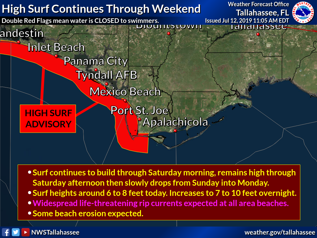
As the storm strengthens, rip currents will be a danger to swimmers. The National Weather Service offices in Tallahassee and Mobile say there’s a high rip current risk from the Forgotten coast westward to Pensacola. They say the rip currents will be frequent and are dangerous for all levels of swimmers this weekend.
In addition, the National Weather Service in Tampa has continued the high rip current risk from Pinellas county southward to Bonita Springs, including St. Petersburg, Sarasota, and Fort Myers. Southerly winds around the organizing tropical storm will make the seas dangerous in these areas through Friday evening.
The rest of Florida will see little change from the typical, mainly afternoon thunderstorms on Friday. As a ridge of high pressure builds over the state from the Bahamas this weekend, the number of afternoon thunderstorms should decrease, particularly over the Peninsula.
Story by Meteorologist Ray Hawthorne of FPREN.


