Tropics are Quiet Now, but Uncertainty Looms Later
Gainesville, Florida – The Tropical Atlantic Ocean is quiet, which is typical for mid-June. However, uncertainty looms on how busy the season may become by August.
This Story Explained....
Meteorologists from the Florida Public Radio Emergency Network will publish an update on the state of the hurricane season around the 1st and 15th of each month. This will include scientific explanations on current oceanic and atmospheric conditions, and how they may (or may not) play a role in the forecast for tropical cyclone activity over the subsequent two weeks. These stories are not meant to replace any forecasts for ongoing tropical activity or potential hazardous weather that may affect Florida in the near future.
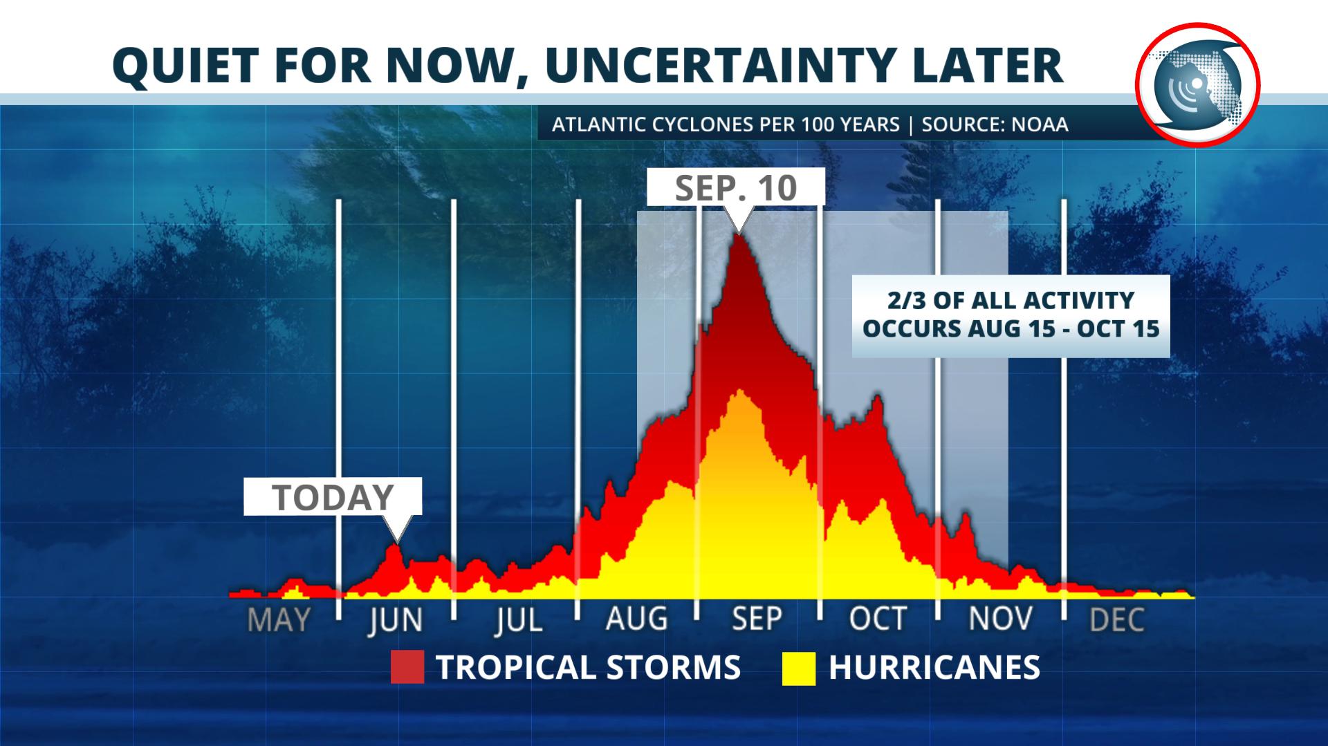
Since 1851, more than two-thirds of all hurricanes in the Atlantic Basin have formed between August 15 and November 15, according to historical records from the National Oceanic and Atmospheric Administration (NOAA).
Climatological data from NOAA also reveals that roughly 80 percent of all tropical storms have formed after August 1st. The graph below represents the distribution of tropical storms and hurricanes that occur over the course of a season.
The Recipe for a Hurricane
Before we dive into the current conditions across the basin, here’s a quick reminder on what must be present for a tropical storm or hurricane to form:
1. Warm ocean waters that are at least 80 degrees Fahrenheit and to a depth of 50 meters.
2. Low wind shear, which is the difference in direction or speed of the wind at various levels of the atmosphere.
3. A pre-existing weather disturbance or area of low pressure.
4. Thunderstorm activity that persists near the area of lower pressure, causing pressures to fall.
QUIET FOR NOW
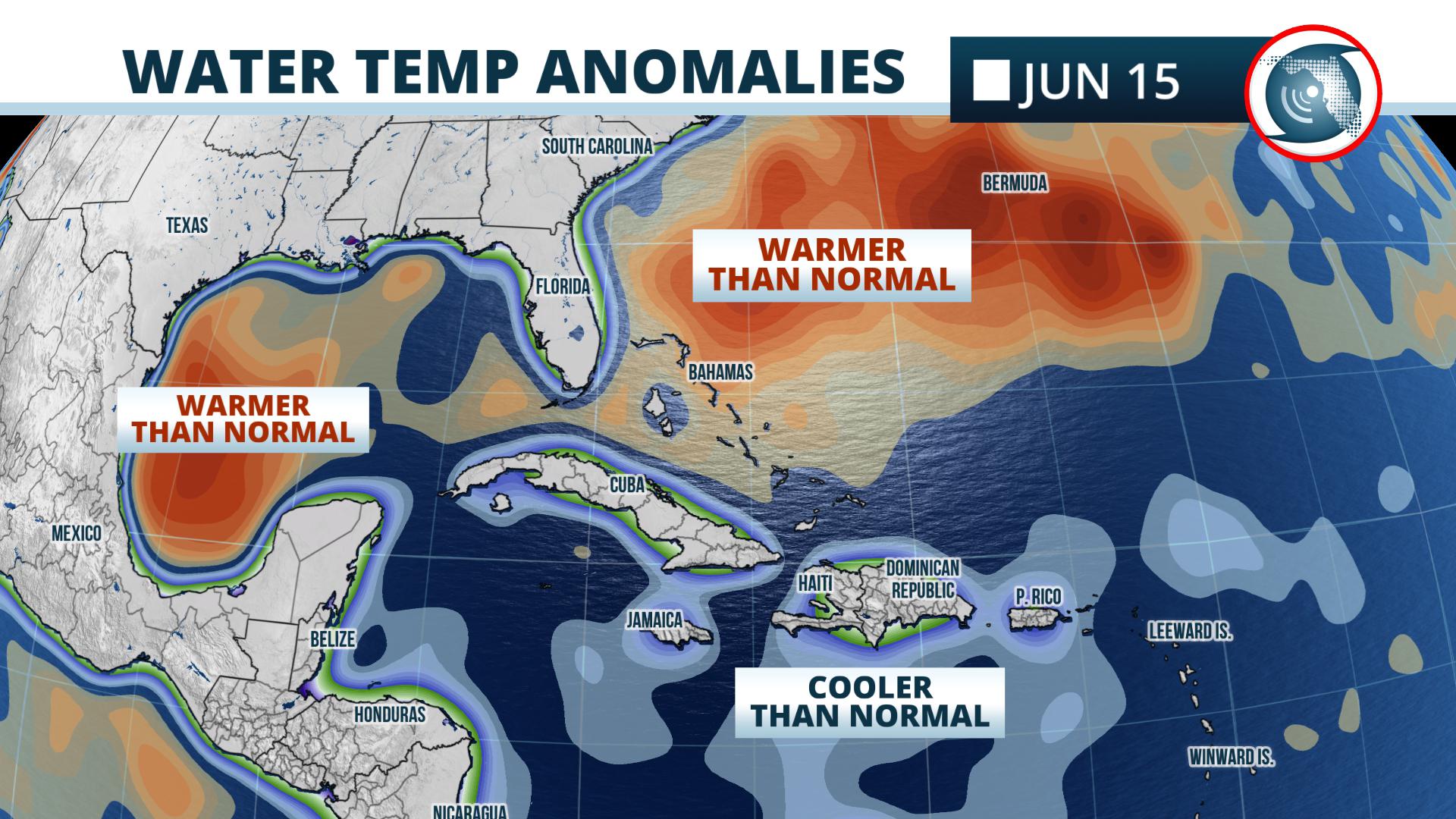
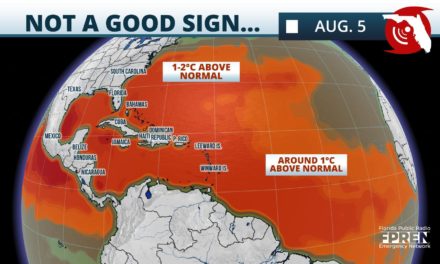
The waters are still a bit too cool in locations where hurricanes commonly form later in the season, such as the central Atlantic Ocean and Caribbean Sea. However, above normal sea surface temperatures have been noted in recent weeks across a large area of the Gulf of Mexico and nearby waters of the western Atlantic. This would make tropical cyclone development possible close to the mainland United States if the other ingredients were present. But they are not.
Upper-level westerly winds are very strong across the Southeast U.S. and Gulf of Mexico, which creates high wind shear and makes it nearly impossible for a tropical entity to develop. This is also a common trait in June due to the presence of decaying frontal boundaries, such as the one that recently produced above-normal precipitation from Florida to South Carolina.
On occasion, the leftover energy and moisture from these weather systems can produce thunderstorms that lead to the formation of tropical storms. However, that is not currently expected based on available short-term forecast data.
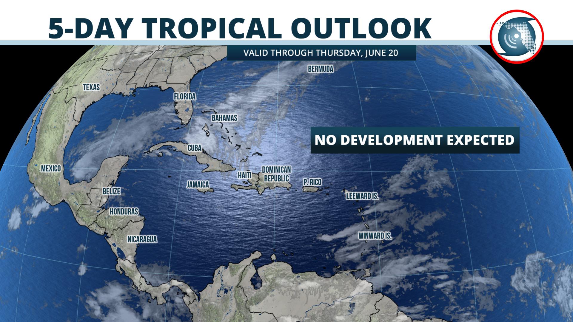
Forecasters at the National Hurricane Center do not expect tropical storm formation over the next five days, and NOAA’s global outlook indicates no tropical cyclone formation is likely over the next two weeks.
UNCERTAINTLY LOOMS IN THE LONG RANGE
Larger-scale climatological factors can play a role in tropical cyclone activity over longer periods of time, and this data can offer clues as to how active the next few weeks may (or may not) be.
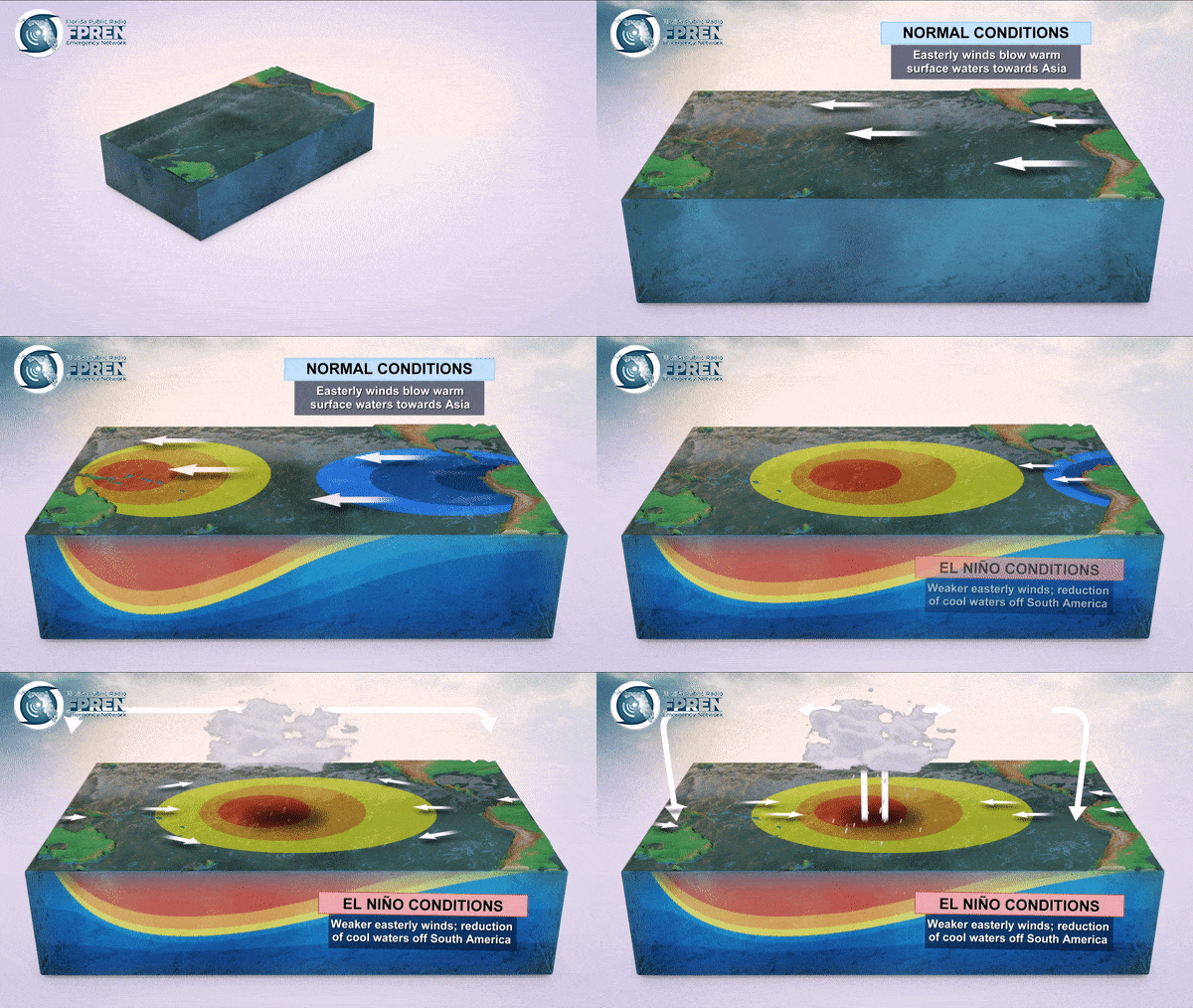
NOAA’s Climate Prediction Center says a weak El Niño is likely to persist this summer, but there is uncertainty on how long it may last. An El Niño is a natural warming of water in the equatorial Pacific Ocean, and it normally produces wind shear that reduces the number of tropical storms in the Atlantic Ocean.
Another climate factor, known as the Madden-Julian Oscillation (MJO, for short), modulates rainfall and thunderstorms in the tropics across the globe. The MJO is currently suppressing precipitation in the western Atlantic Ocean, Caribbean, and Gulf of Mexico. All of these factors are stacked against tropical storm and hurricane development in the coming weeks.
As the peak of the season approaches in August, September and October, the Climate Prediction Center says there are reduced chances of the El Niño lasting into the fall. What happens with El Nino, the MJO, and other factors like the West African Monsoon (where many tropical disturbances are born) will ultimately have a say on how active the hurricane season becomes.
It’s too early to tell for sure how each of these factors will contribute, but climatology alone suggests more tropical activity is likely into the fall months of August, September and October.
Meteorologist Megan Borowski and Forecaster Henry Coburn contributed to this report.
WKGC is the FPREN station for Florida Panhandle.
This post will expire at 6:00 pm on Monday June 17th, 2019


